
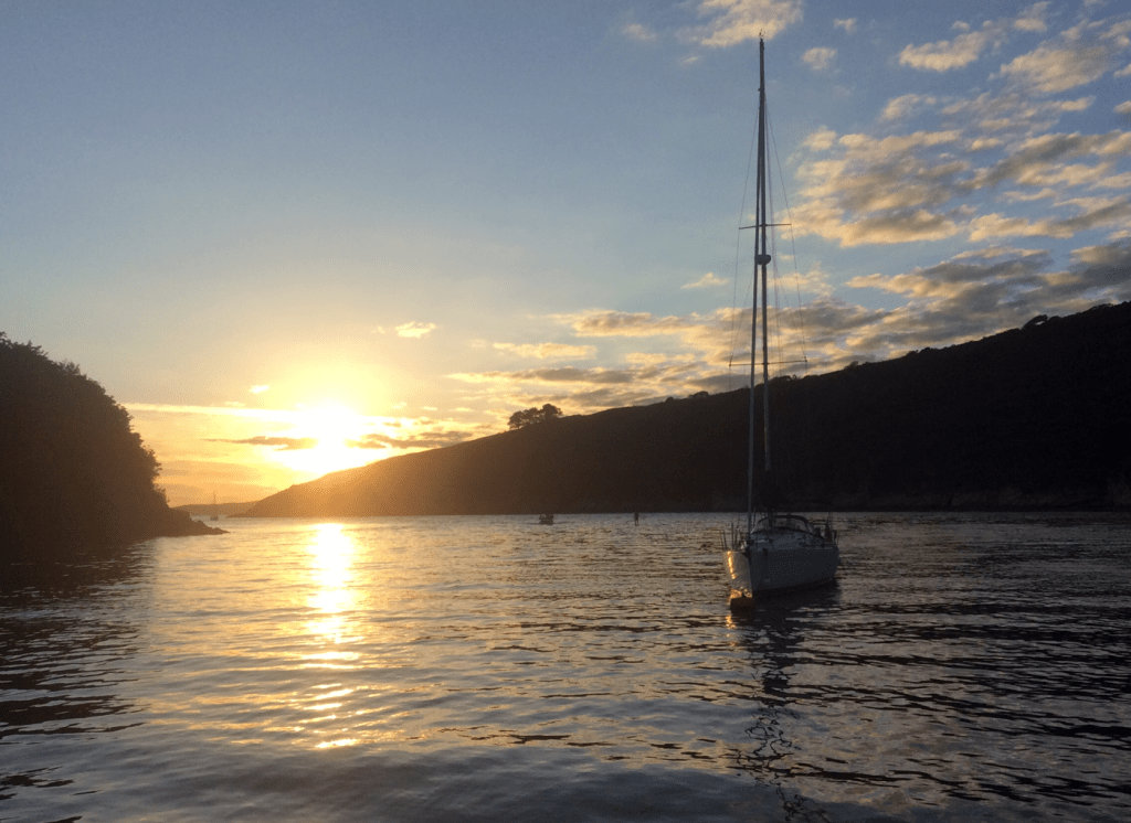
Friday 28 August
Welcome to Liquid Asset Cruise 2020
This year is different because of Covid 19 – the season is different, weather systems and daylight hours have changed and therefore we will have to adapt to new conditions. It is likely we will have stronger winds that may restrict our time sailing in open seas. So let’s begin…
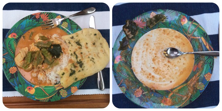
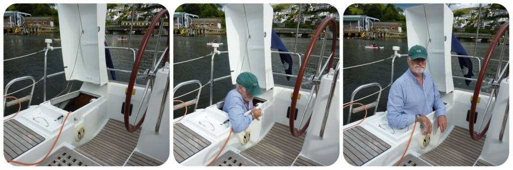
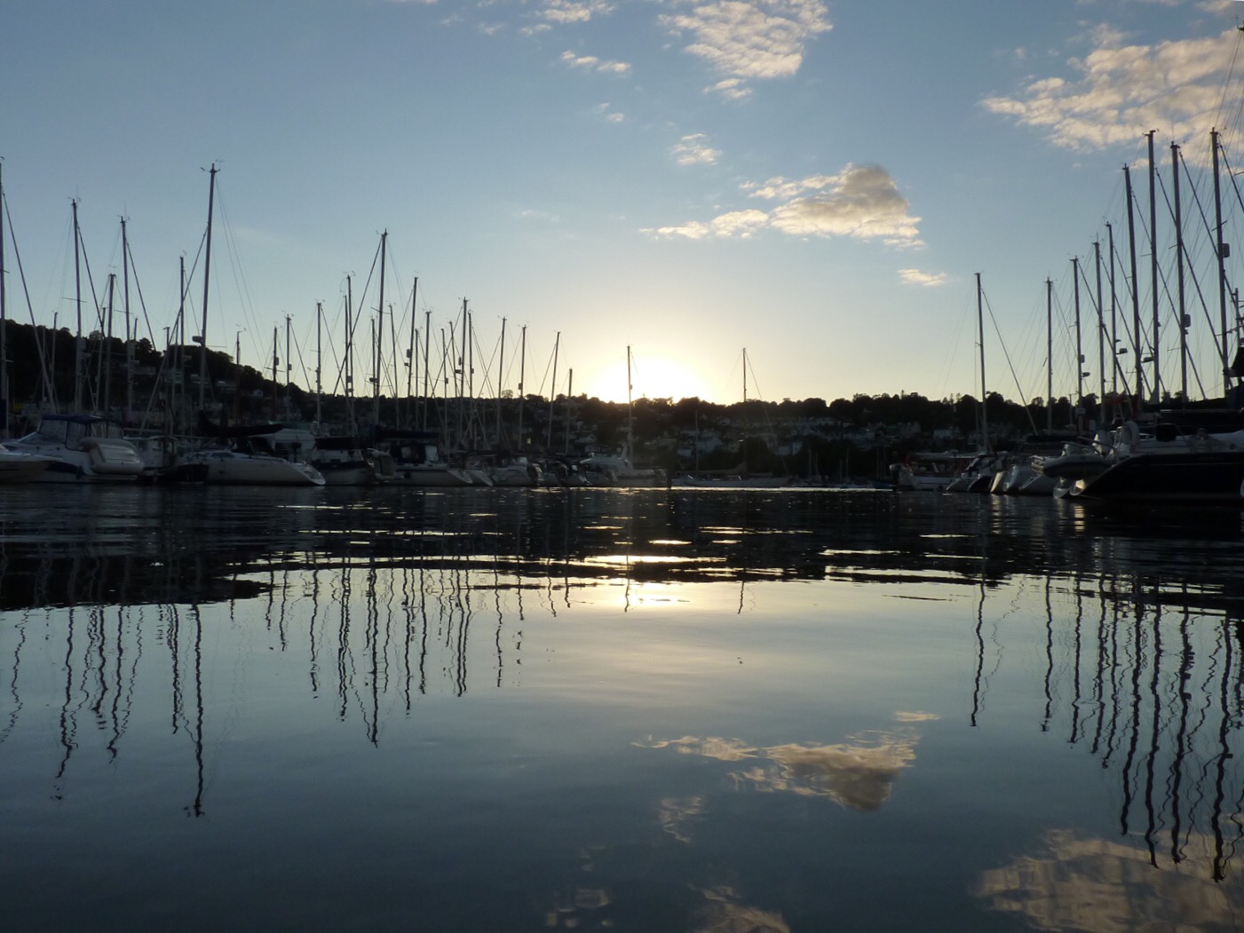
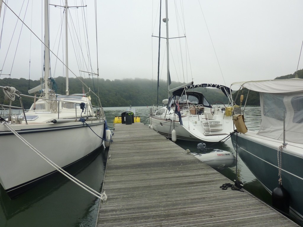
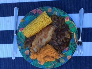
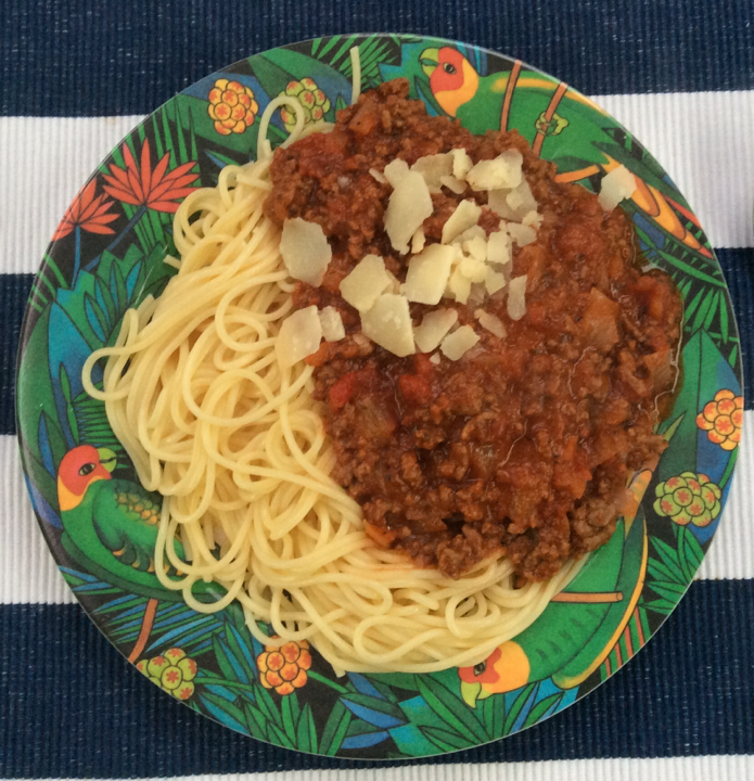
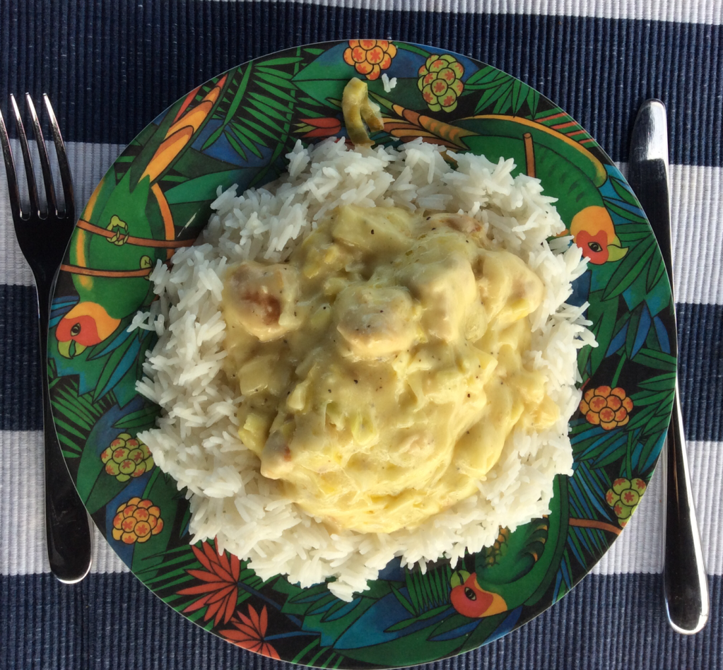
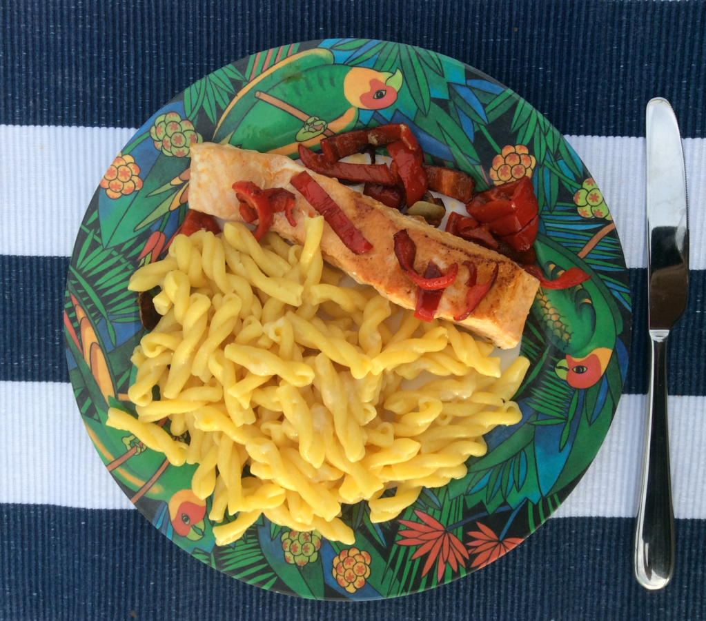
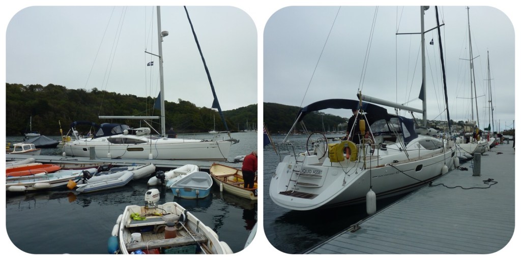
The crew met together and traveled to Darthaven Marina to board Liquid Asset. After traveling so many miles, it was time to relax, take a deep breath of sea air and prepare our first meal on board. Easy, just follow the instructions by heating the sauce, adjusting the herbs, heating some nan bread and boiling the rice. Abracadabra (thanks Annie).
What is it like to sail? is a question often asked. Perhaps it’s like manoeuvring a heavy shopping trolley down a gentle slope and attempting to avoid the obstacles on the way. Except the ‘trolley’ weighs 10 tonne and there is also a couple of large pieces of cloth 90 sq metre flapping in the wind attached to a tall pole.
Route planning
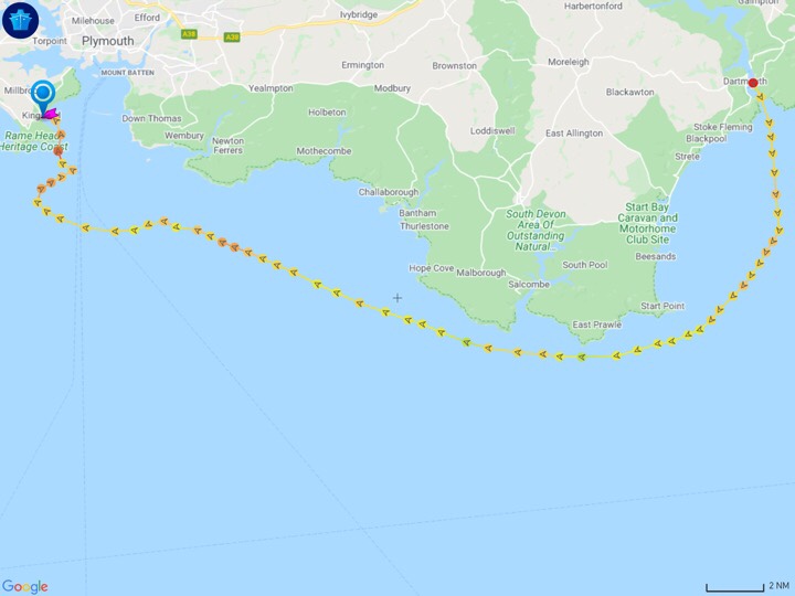
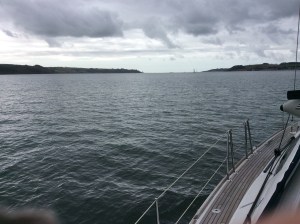
France and Channel Islands are off limits due to quarantine restrictions so we must head westward along the coast. Strangely for this time of year there will be little wind from Monday afternoon until Wednesday. So we planned to set off early on Monday morning and catch the northerlies for as long as possible.
Destinations
We have decided to seek quiet anchorages along the south coast and cook most meals on board. The challenge will be to discover new destinations and this will require carefully studying the detailed charts. Liquid Asset has a two metre draft (the distance from surface to bottom of keel) and this restricts our manoeuvring in shallower waters.
Zzzz
Saturday 29 August
Today we prepared Liquid Asset for the next two weeks. Firstly victualling and we successfully bought for all our onboard meals – nothing fancy – plain home cooking by following a low fat, low sugar and high fibre diet. Photos to follow. The rest of the day was consumed by fixing, checking and testing.
- Fixed port navigation light
- Replaced velocity paddle
- Defrosted fridge
- Inflated dingy and tested outboard engine
- Pressurised hot water system
- Pressurised central heating system
- Checked first aid kit
- Replaced gas cylinder in life jacket
- Refuelled with diesel at fuel barge
- Checked deck fittings and running and standing rigging
- Replaced Gaz cylinder for cooking
- Engine checks
- Life raft checks
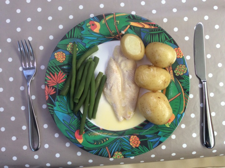
The town clock struck six bells and we were finished with all the chores. Time to eat basa fish and fresh vegetables.
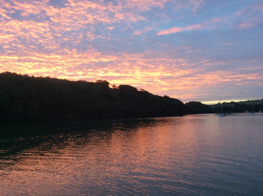
We ended a busy day by walking along the path to the Upper ferry and to catch the fading rays of evening sunlight.
Zzzz
Sunday 30 August
Editors note : the cruise blog is prepared daily however we are often out of reach of WiFi masts and may even arrive into a ‘dead spot‘ with no reception. There is a link in menu bar for you to send any comments or feedback.
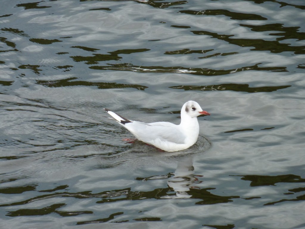
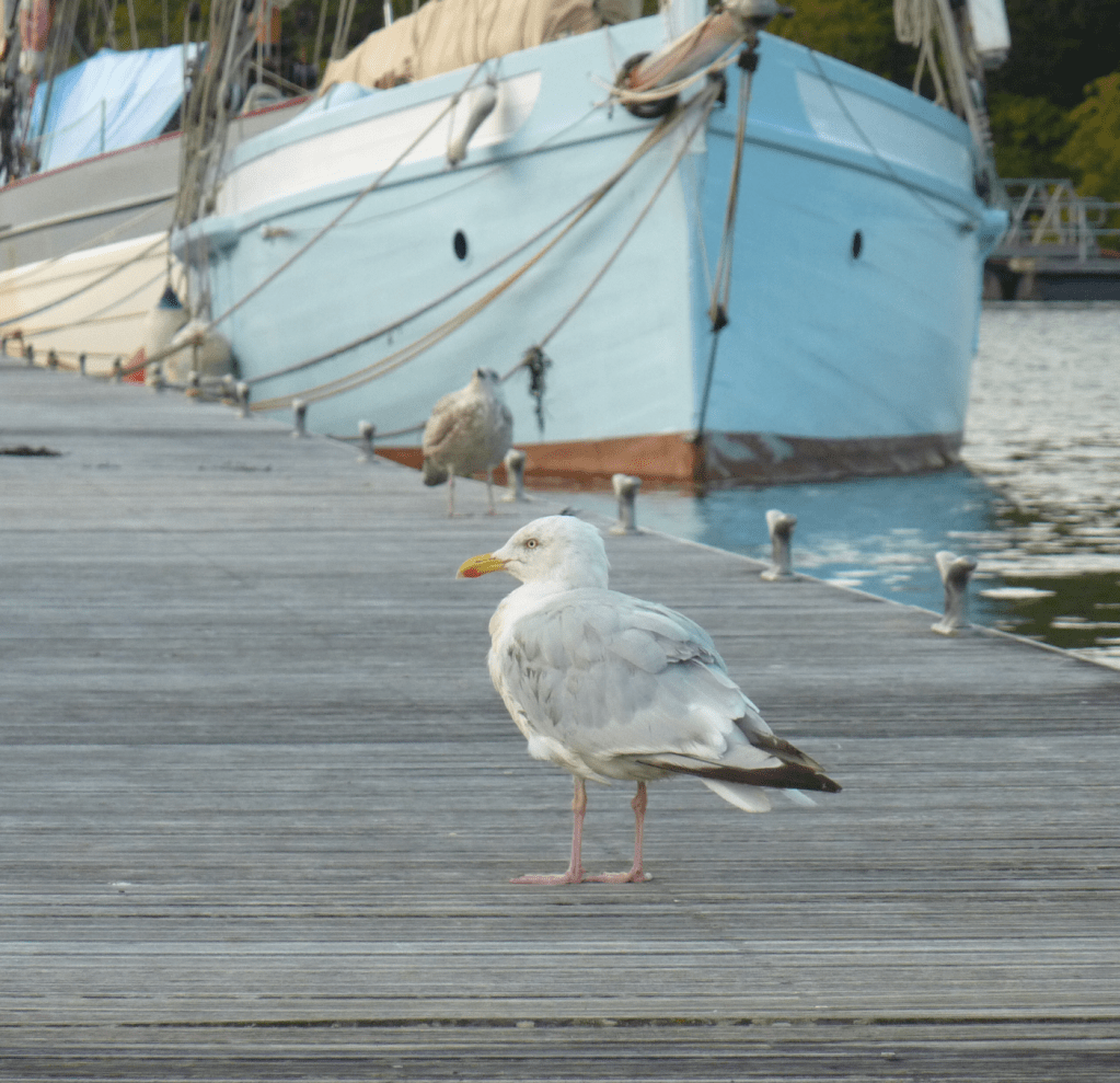
Seabirds
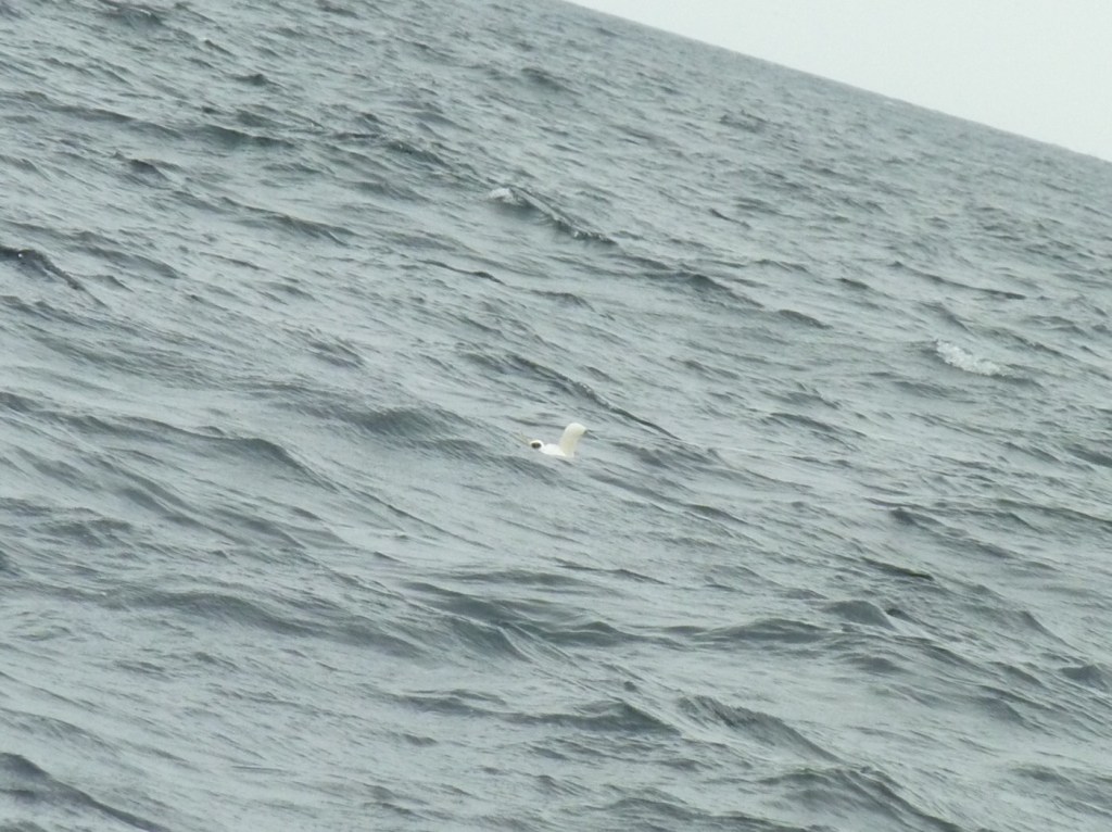
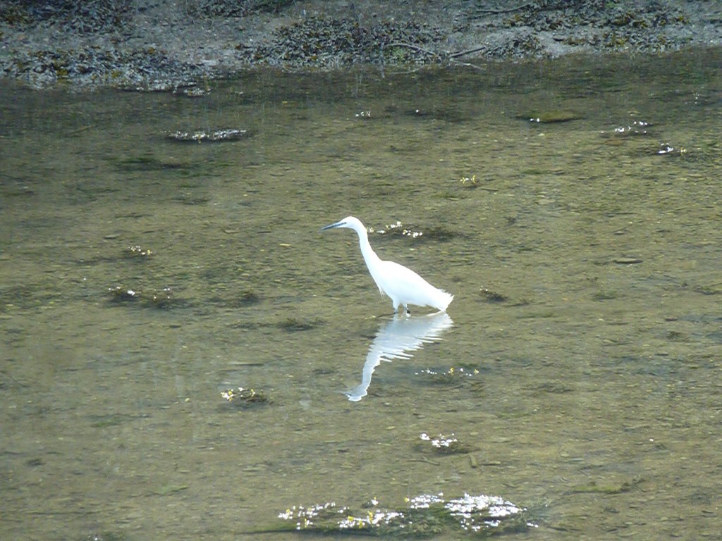
Followers have requested that we photograph seabirds and they can be identified in the comforts of home. Although our cameras are efficient on dry land, the sea conditions and flight speeds of many seabirds may limit the scope of this request – let’s have a go.
The town clock struck seven bells and we cast off from the pontoon and out to sea and into the ‘mysterious beyond’…
Sailing checklist for ideal conditions
- Steady 12 knot winds
- Sailing directly to destination on a single starboard tack
- Beam reach
- Tide in direction of heading
- Flat seas with no fetch
- No obstacles or fishing vessels
- Arrival mid afternoon
- Sunny

Today was that day… steady northerlies 12 kts all morning as forecast and full set of sails catching the wind. 10 tonne moved by 90 sq metre of ‘cloth’ at maximum speed over ground of 9.4 kts
As we approached our destination the winds dropped to 6 kts and backed (as forecast). A change in heading and now off course however we continued to sail but more slowly.
Then unexpectedly the strength increased and we made several tacks best to windward. With one nautical mile NM off the waypoint we started the engine and motored to our anchorage.

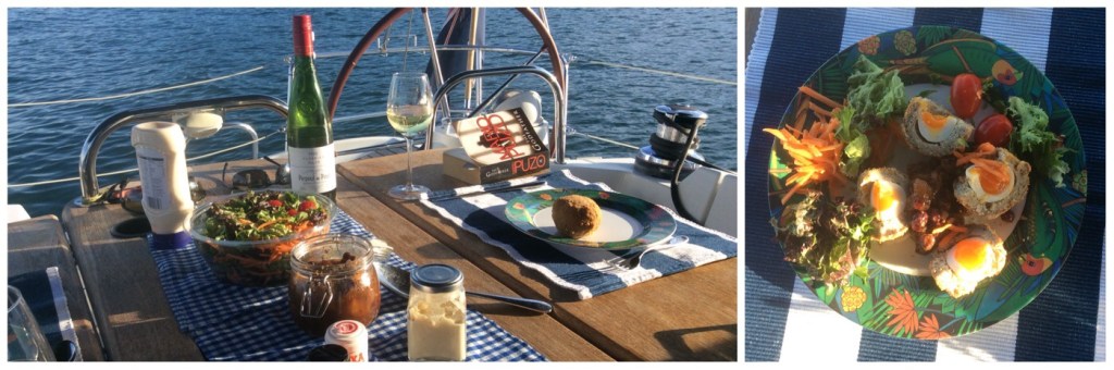
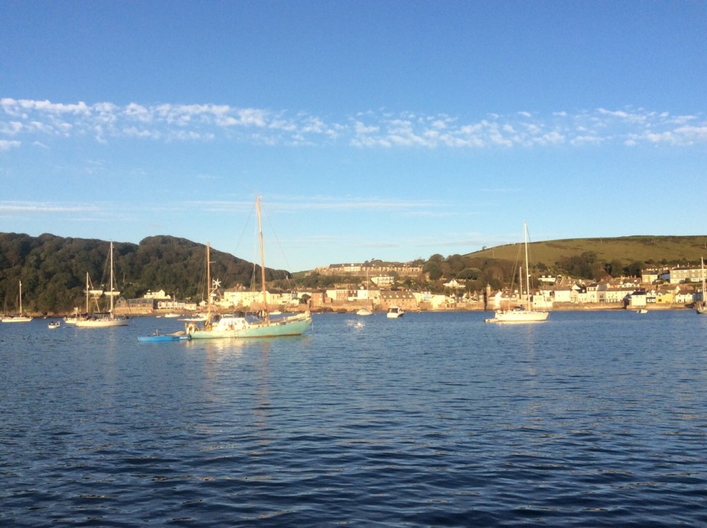
14:00 Anchorage
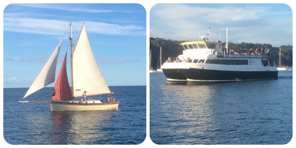
We set an anchor in 7 metre depth and checked the tidal range today was 3.3 metre. So plenty of depth below our 2 metre keel. After a tuna roll we sat back under the bimini and watched the world pass behind us. Passenger liner to Roscoff, oil tanker to Plymouth, sailing yachts, ‘party boats’, jet skiers, paddle boards and passenger ferry to Cawsands. All making way for trade or pleasure.
We ended a fine day’s sailing with fine dining on deck in fading light before retiring below with our anchor light shining from the top of the mast.
Gently rocking at anchor until
Zzzz
Monday 31 August
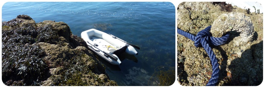
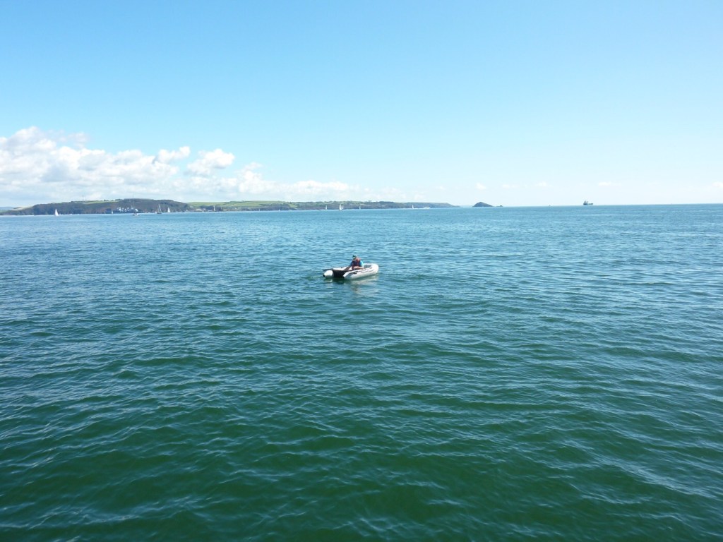
10:00 Dingy trip
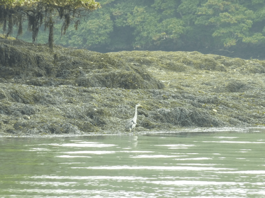
With little wind and smooth water, it is an ideal opportunity to explore the shoreline and perhaps photograph some seabirds. The small beaches were slowly filling up with day trippers so decided to row along the rocky shoreline for a suitable landing spot. And hidden under barnacles was a ring fixed into the rocks. However very few birds to be seen with only an oyster catcher flying by. Or perhaps you can find this seabird picking food among the seaweed.

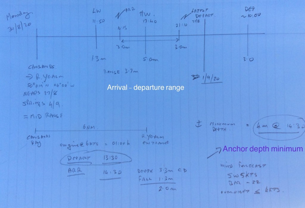
11:30 Passage planning to R Yealm
The River Yealm anchorage is a challenge for deep keeled yachts because it is protected by a shallow bar across the entrance and is a very popular destination (space to anchor). We will attempt to our reach this idyllic place by careful planning and real time depth measurements. If successful we may be out of WiFi signal for 24 hours.
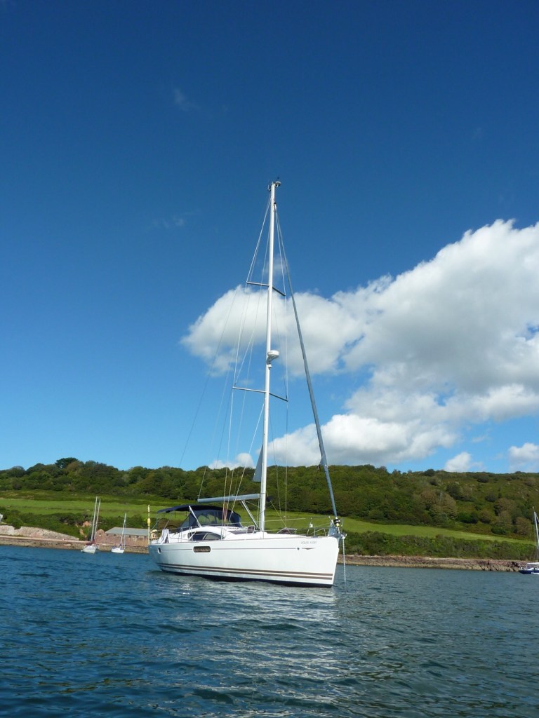
With little wind and smooth water, it is an ideal opportunity to take some exercise and perhaps photograph Liquid Asset from afar.
13:30 Departure
Hope to be back in touch soon…
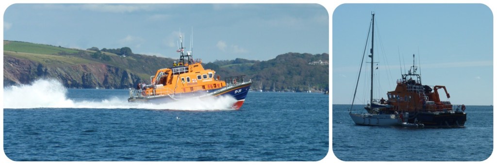
Motoring across the entrance of Plymouth Sound can be uneventful with attention needed by the helmsman to avoid all manner of vessels including divers below, fishing boats and a plethora of smaller craft heading back to port. However in this group a yacht had started to take in water and needed urgent assistance.
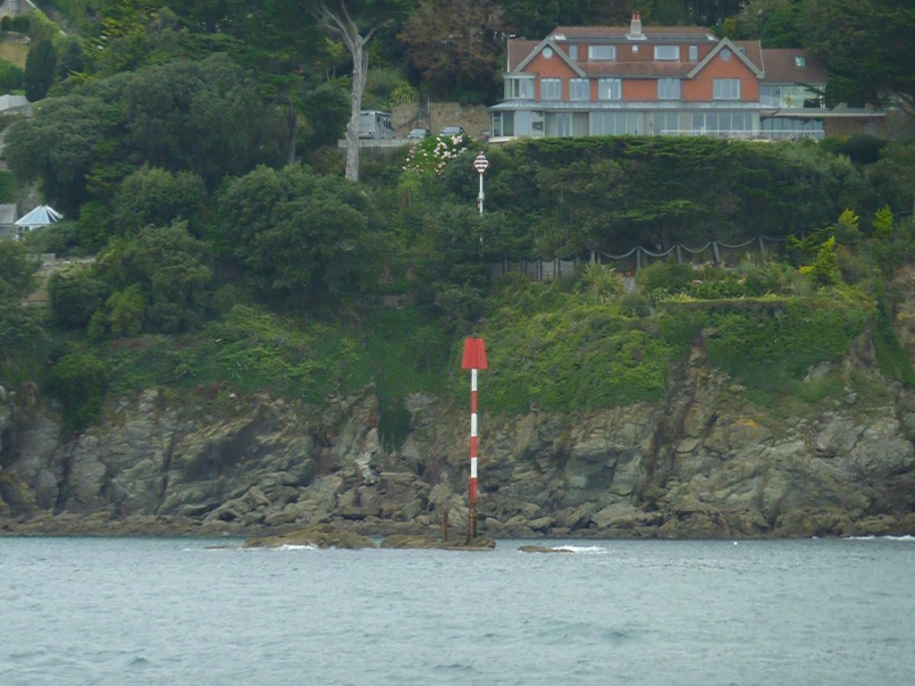
Entrance River Yealm
Photo MarineTraffic
We slowly approached the narrow entrance firstly by identifying the leading line markers built into the hill side. Two fixed marks in line allowed the helmsman to stay in the safest and the deepest waters. The incoming tide had added 3 metre to Chart Datum (the seabed). Then leaving red buoys to port before rounding on to the next set of leading lines. And we were not alone with other vessels in both directions squeezing through this narrow section.
Not quite there yet as we reached the congested anchorage in a fast moving tidal flow. Fortunately a yacht was ready for departure and we turned 180 degree and picked up the vacant mooring buoy. Safely attached we could now appreciate everything on offer – shelter, tranquility, and later on absolute silence…
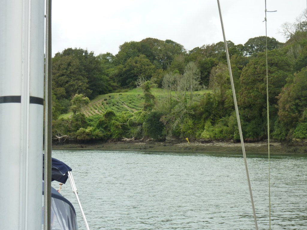
Exploring the river
We set off to explore the upper reaches in the dingy not knowing what was around the corner except the Sun Inn known from a previous visit. The river stretched for miles and was filled with hundreds of yachts. The houses along the steep shoreline all had balconies for the occupants to catch the sun and views. We did pass by the pub and you may guess how busy it looked on a sunny evening on Bank Holiday Monday.

Back on board Liquid Asset, dinner was prepared and the evening light transformed the hustle and bustle into peace and quiet. Steak and roasted vegetables on deck as the sun went down leaving only the sound of owls to break the silence. Moonlight dancing on the smooth waters of the River Yealm. Perfect spot.
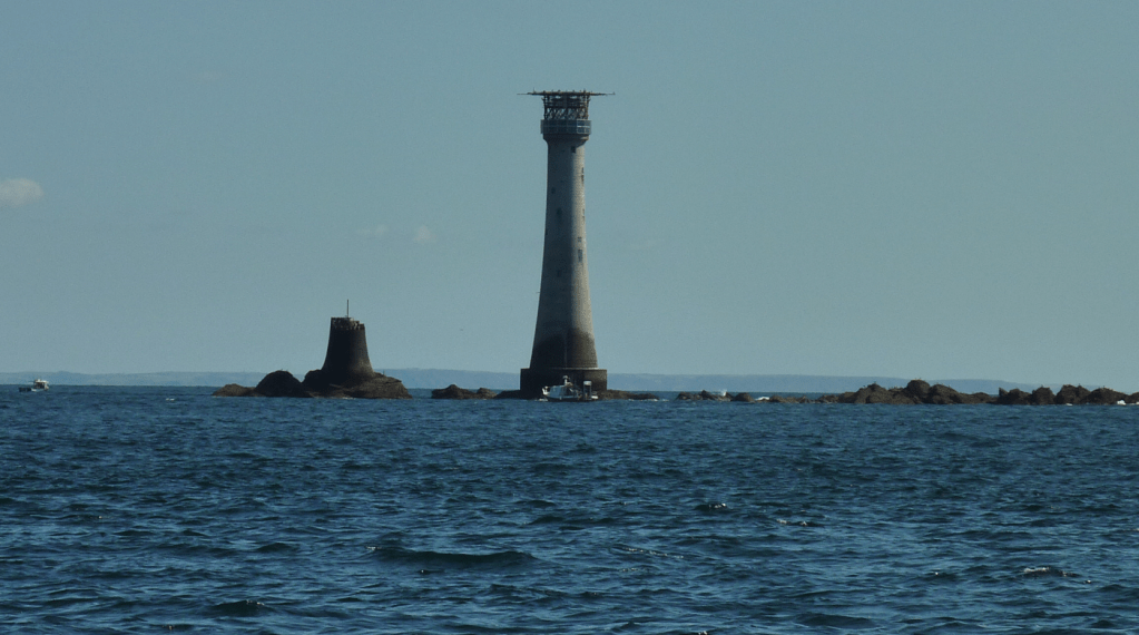
Tuesday 1 September ‘To the Lighthouse’
We calculated the latest time to depart before the ‘window of opportunity’ closed. 10:00 to be safe and so we dropped off the mooring buoy soon after 09:00 and turned round into the ebbing tide. Yesterday’s route was carefully followed and with 1.3 metre under the keel, we were soon out into open seas. Our initial plan to motor to Cawsands Bay was changed. There was a steady southeasterly 9kts (force 3) and we set a course heading towards the Canaries. Perhaps wisdom tempered our ambition so a slight change of direction and an opportunity to see Eddystone Lighthouse (distance 7NM) more closely.
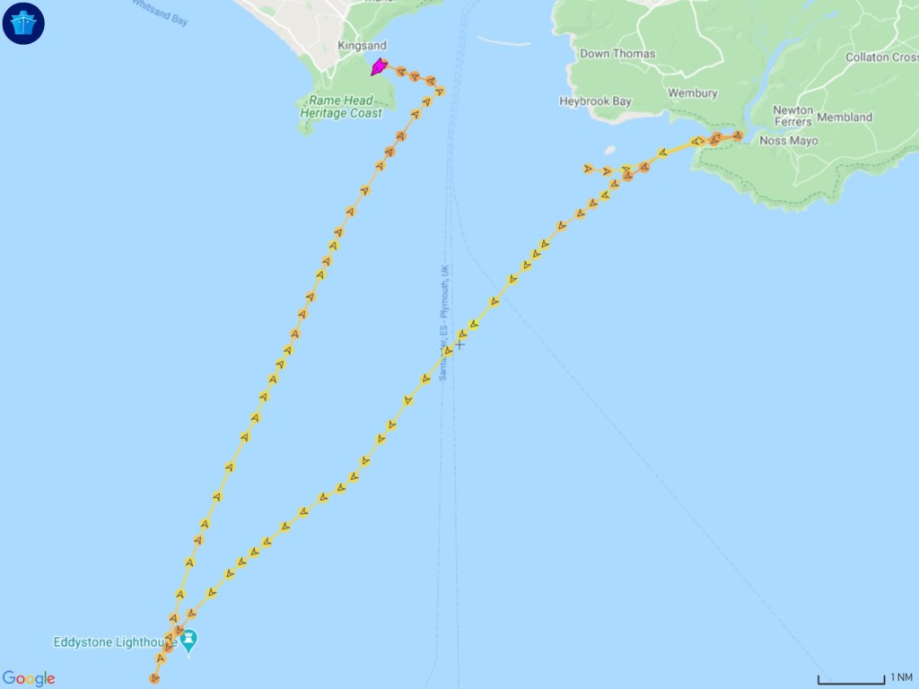
Then back to yesterday’s starting point taking advantage of the steady southwesterly. We anchored close to the wooded shoreline with very few neighbours.
The afternoon was time to relax, listen to music and let the aromatic spices from the chef’s cooking waft out over the bay. It seems that tonight will be special – home cooking followed by spectacular planetary events in the cloudless sky.

Harvest Full Moon
After a delicious meal we sat back and waited for the show to begin. Then slowly our moon appeared from behind Bolt Head to rise up in a full orange ball of light – the Harvest Moon 99.9% Centre stage.
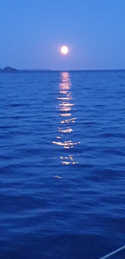
Meanwhile a sideshow was slowly getting ready – Saturn, Pluto and Jupiter, aligned to centre stage, made their appearance.
Wednesday 2 September :: 06:22
06:22 Full Moon as it sets behind the western horizon and just before the Sun rises 06:34 in the east in the constellation of Leo. Not to be missed, Venus is just above the Sun and Neptune is just above the Moon. The show is now over.
- Cast in order of appearance
- Harvest Moon
- Jupiter
- Saturn
- Pluto
- Venus
- Neptune
- Sun
Tides

Last night’s lunar events have a real significance as we move into the Spring range of tides. The difference between high water MHWS and low water MLWS is 5 metre (15 feet). The Moon’s gravitational force is lifting the surface of the water away from the Earth’s centre by 5 metre every day. The other tide is the effect of the earth’s centrifugal spin and gives us two high tides per day.
So first task of the day – you guessed – calculations for tidal flow and range…
May be out of range for a time. Hope to be back in touch soon…
VMG & Passage Planning :: Lessons learned
Every day we work to a plan built on our ambitions, experience, environment and the unexpected. Planning helps to achieve all this and more. Examples include traveling from A to B, what we eat and where we go today, next week or next year.
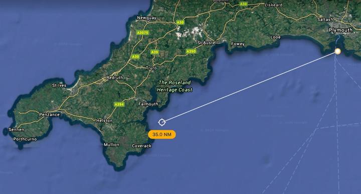
Today’s plan was to use the strengthening south winds to sail 35 NM to R Fal and attach ourselves on a deserted pontoon for protection overnight. ETA 15:00 winds S F4, tide flowing west. What could possibly go wrong?
- Terminology
- SPD Speed of vessels through the water
- SOG Speed over ground – speed of vessel over the ground (+tide / wind)
- VMG Velocity made good – velocity of vessel to waypoint
- WP Waypoint – Point on chart usually destination
- DTW Distance to waypoint
- BTW Bearing to waypoint – compass reading (degree)
- NM Nautical mile – measurement of distance
- KTS Knots – measurement of speed
- Minute – measurement of time / measure of distance
09:30 Departure
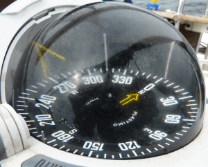
We rounded Rame Head and met our wind for today southerly 14 kts F4 and DTW 35 NM BTW 250 SOG 7.4 kts. All good so far as we made way through the choppy seas. Attempts to photograph gannets gliding and diving still proved very difficult.
13:30 Wind shift and strengthening :: SW 16 kts F5
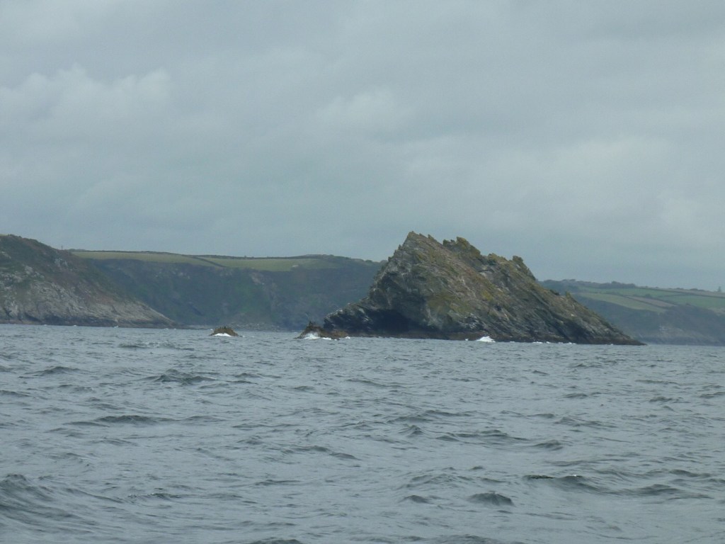
Having sailed 25 NM in ideal conditions the environment changed, with a wind shift veering to SW and blowing now at F5. We had to reduce our sail area and determined that we couldn’t point to our WP. Instead the rocks off Nare Head (Gull Rock and The Whelps) were ahead. “Ready to tack, ready, helms a lee, lee ho”. Several tacks later and 2 hours added to our journey, we arrived at the WP outside River Fal. It was still a great sail though.

Lesson learned – check every detail of the passage plan (wind speeds and direction ) and take account of forecast for wind shifts.
16:30 Sailing through Carrick Roads :: Crowded pontoon
Carrick Roads is an open space of water and the harbour Falmouth. The channel however is narrow and follows the course of the river with shallows on either side. We sailed along gybing at each bend. Soon we were in quiet waters and the final destination in sight – our ‘empty’ pontoon was packed. A finger of space at the end and we ferry guided into place.
Thursday 3 September
We decided to stay here a couple of nights sheltered from strengthening winds. We spent a quiet time on board as the grey drizzle set in.
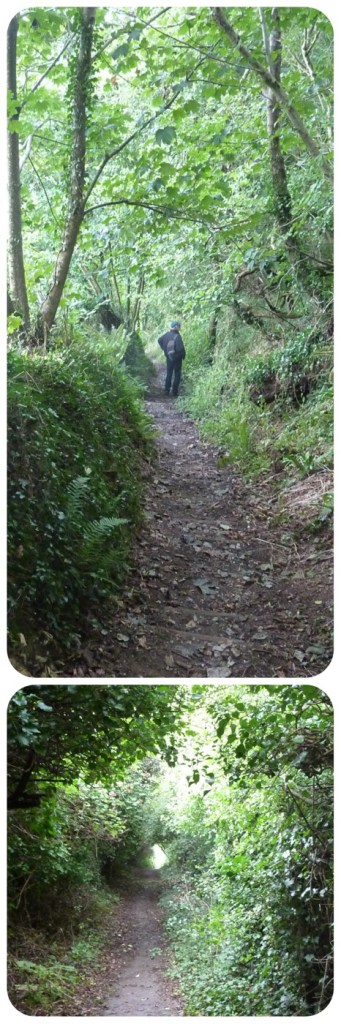
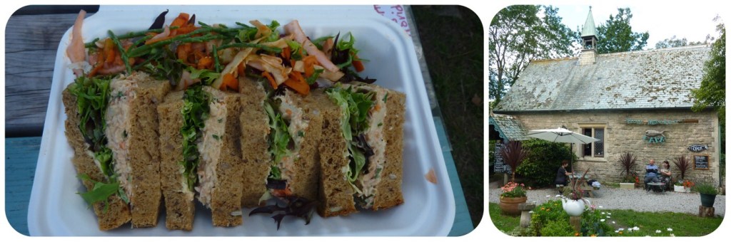
14:00 Shore party :: A walk in the countryside
A short trip in the dingy to Malpas landing pontoon and then a chance to stand on solid ground. At sea level the view was very pleasing so we set off through narrow country lanes to the hill top. Birdsong in the tree tops (robin and chiffchaff ) and nature’s larder ready to pick – brambles, sloe berries and hazelnuts. The views then spread out before us of rolling countryside to Truro cathedral and the river below.
Google Earth Link to Malpas
18:00 Evening :: BirdNET
Supper served on deck and time to test the app that can identify birds from their birdsong. We were surrounded by a cacophony of noises including herring gull, owl and oyster catcher. The app worked perfectly whilst ashore however this time it could only identify one species – HUMAN. We left our neighbours chattering into the night and sought peace below deck.
Tomorrow is another day… Malt and zzzzzz
Passage planning for tomorrow was straightforward (navigator thought) and when asked for a departure time the reply was simply “after breakfast“ From previous lessons learned, could that be acceptable? Let’s wait and see…
May be out of range for a time. Hope to be back in touch soon…
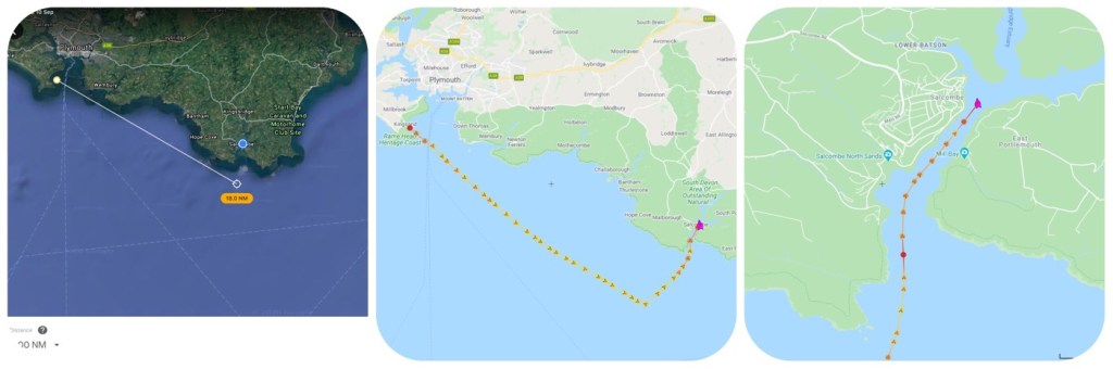
Friday 4 September :: Channel navigation :: Coverack
During breakfast we noticed all the other yachts were leaving one by one. Was there a tidal gate on the river not to be missed on the falling tide? We had planned to sail to Coverack (distance 7 NM) and drop an anchor in the bay. Steady west winds and no wind shifts. Would you be happy to finish breakfast in this peaceful place?

After breakfast, we departed and motored down the tree lined river, turned about to photograph seabirds, noticed a tea plantation on riverbank, checked the water station at Trelissick before arriving at the ‘pinch point’. Was there enough depth left in the narrow dog leg? Yes – there was and we were back out in open waters.
Navigating by depth
It looked so easy to reach the open seas as the water surface of Carrick Roads stretched out towards the horizon. However we had to snake our way along a narrow and winding route by following the 10 metre contour.
Contour navigation – position the vessel onto depth contour and note the depth reading. Head in the direction of travel until the reading starts to rise then turn into the shallow area until reading starts to fall. Turn again to deeper waters and repeat each time you reach your safe limits. We maintained a steady course between 9.5 m – 11.5 m until safely out of the narrows.
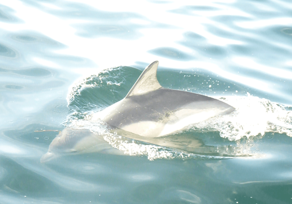
Dolphins :: Coverack anchorage
Our first sightings of dolphins as we departed estuary. Raised the sails and headed to Manacles east cardinal. Steady NW winds for sailing on broad reach (AWS 15 kts, AWA 50, SOG 7.5 kts) then headed to Coverack on beam reach SOG 7.4 kts. A pod of dolphins passed by breaking the surface as they swam effortlessly alongside. 14:15 dropped anchor in sheltered Coverack Bay for lunch. Prepared evening meal sauce to marinate.

River Helford :: WiFi black spot
16:15 Motored back towards River Helford anchorage where sheltered waters offered quiet refuge. It also offers no WiFi signal ‘far from the madding crowd’
18:00 Everyone’s favourite ‘spagbol’ didn’t last long on the plate. All was quiet onboard as the winds funnelled down the valley. The day was complete and all done ‘after breakfast’
Saturday 5 September :: Lizard Point
The forecast was steady NW winds f 3/4 with occasional squalls. A squall is when a rain cloud passes overhead and the down draft is added to the prevailing wind strength. The conditions were ideal to sail towards Lizard Point. We set off out to sea in force 4 (12 kts) and Coverack abeam in good time.
Squalls :: Gusting 20 kts
Dark squall clouds above and suddenly the wind strengthen from 11 kts to 20 kts. The boat heeled over as the sails were hit with double strength winds. Instinctively the main sheet was released and the main sail lost all power (spilling wind). It was time to shorten all sails and reduce by reefing in. Within 5 minutes the sails had been reduced to 3 reefs and we continued on course towards Lizard Point.
12:00 40 55.54’ N 5 13.10 W :: West-most point
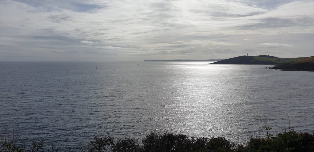
Lizard Point is southern most point of mainland UK and as it came into view deep Atlantic swells headed our way. Liquid Asset was soon into its rhythm up and down as we moved further away from land. We always recommend a same distance off and the reason became apparent. Even on a quiet day we could see breaking waves ahead where sea currents meet reefs deep below. We had reached the place and time to turn and head homewards.


Making way or at anchor :: Rules of the Road
‘Collision Regs’ (Highway Code) direct traffic at sea and the formidable MYGAS was directly ahead. How much space did we need to leave as we sailed towards it? Then the signal was seen – an anchor ball set above fore deck on every vessel when attached to the ground. MYGAS at anchor even in these deep waters.

Having left MYGAS to starboard, we continued to sail all the way back to the entrance of River Helford in fresh steady winds – SOG 6.2 kts. Sails can be set to capture wind from most directions – all except 90 degree ahead. The secret for today’s sailing in strong winds was to create a ‘slot’ between the head sail and main sail. The wind hits the sails and is forced through the slot to creat a lift. This effect helps the helmsman to point closer to the wind AWA under control and the sails were tight, quiet and very efficient.

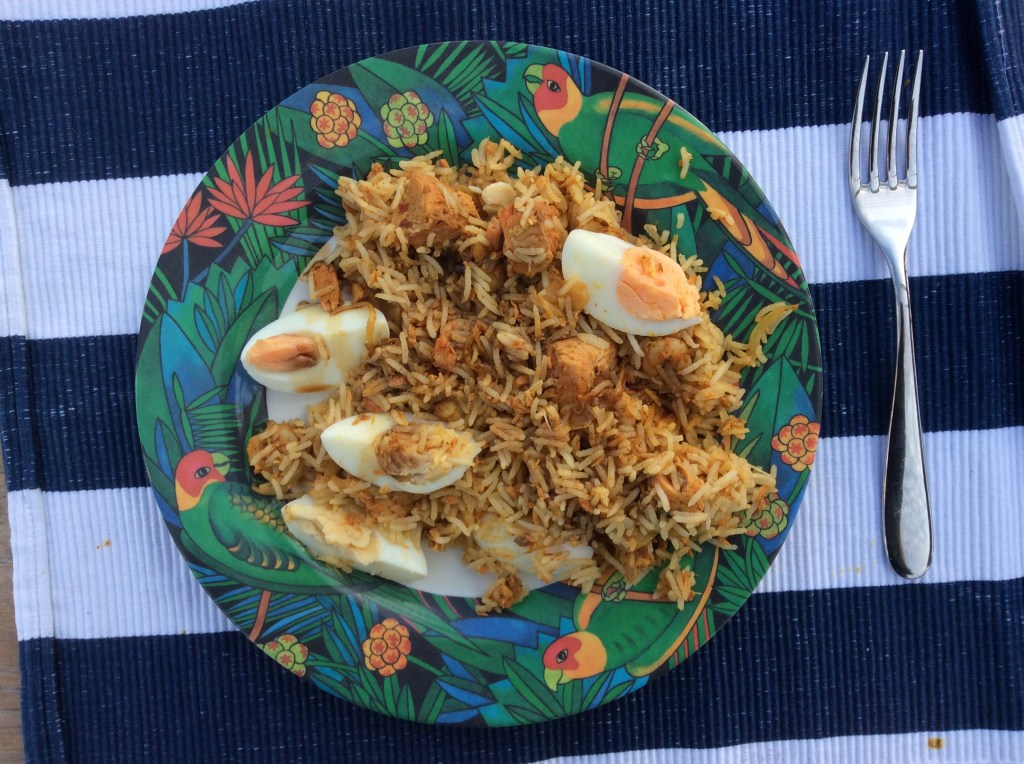
16:00 Dropped anchor off Trebah National Trust’s beach in this idyllic spot. Sheltered from prevailing winds, we were settled here for another couple of nights. The annual culinary highlight of Kedgeree was slowly taking shape in the galley and then served on deck. The yacht swings about the anchor bring different perspectives into view very few minutes.
Sunday 6 September :: Exploring River Helford
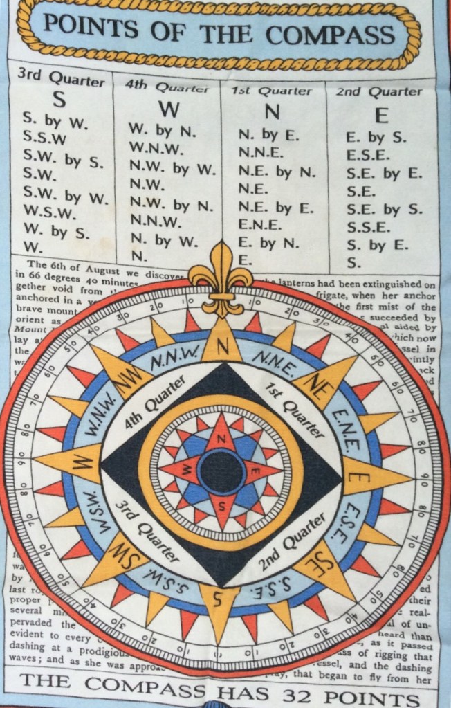
Sunday’s competition – how many points of sailing on a compass and name them with eyes closed.
10:00 Shore party to Helford
Helford is a quiet village set on the bank of the river opposite Helford Passage. A small ferry boat plied back and forth between the two sides. A shallow stream ran through the village and we strolled along narrow streets.

Morning became afternoon and we headed back towards the pontoon knowing the tide was falling.
The sun was high in the sky and we reached a converted chapel ‘The Holy Mackerel ‘ where lunches were being served outside under shade of large trees. Delicious home-made crab sandwiches hit the spot. Then back to the dingy. Although high and dry in the mud, it was an easy lift to deeper waters and soon we were exploring the upper reaches of the River in the afternoon sunshine.
Back onboard, there was temptation to swim in the cool waters… drysuit donned and safety lines stretched out behind the boat, temptation became reality – it wasn’t really that cold (honest). Swimming soon became popular and others began to jump into the water from a nearby rowing boat.
Damsel in Distress
After swimming about and showering from the aft platform, we sat and watched others and realised they may struggle to get back into their high sided craft. After several failed attempts one of their party shouted over for assistance and we were able to offer help. ‘Damsel’ had a fashion business in London and seemed very relieved to be able to climb out. Soon they were all reunited and disappeared up river.
Chicken and Leek Supreme on deck and the sun set on another day on Liquid Asset.
Monday 7 September :: Fowey :: Dolphins
07:00 Off “before breakfast “ to catch the tide to Fowey due to a gentle wind from NW by W. Straightforward 20 NM passage.
Mist in the valley was slow to clear as we raised anchor and headed out to open seas.
A low flying passenger jet flew over our heads and began to turn and fly in circles about 200 feet above the sea. After many times, releasing fuel at intervals, it resumed its flight from Newquay to East Midlands.
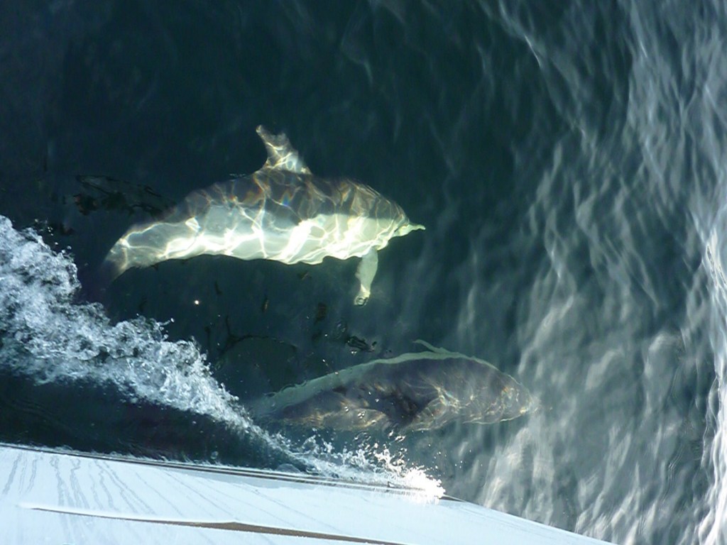
Fins began to break the surface and a pod of dolphins fishing were attracted by our underwater shape. Soon they were weaving and leaping in front of the bow blowing air and ‘talking’ to each other. Occasionally glancing up at the humans on Liquid Asset.
12:00 We continued to sail straight into Fowey harbour as the winds on arrival. Visitor mooring buoys were available however their pickup buoys were not present. LA has a high sided freeboard and the only low area is our aft platform. Carefully we positioned our port side against the buoy and moved forward ready to pick up from the platform. As the buoy appeared, our first attempt missed the mark and Skip lost balance and gracefully dived in. A short swim and soon back on board. The second attempt was successful.
An afternoon visit to Polruan and a steep climb to the top with fine views out to sea.
17:00 We sat on the quayside eating ice creams and planned our last few anchorages. (Thursday no winds) Either:-
- Fowey 2 nights – Cawsands/Yealm 1 night
- Fowey 1 night – Cawsands 1 night – Yealm 1 night
- Fowey 1 night – Cawsands/Yealm 1 night – Salcombe 1 night
What would you think was the best plan to follow for next 3 nights?
Tuesday 8 September :: Royal Navy
10:00 Time to fill our water tanks with fresh supply from the water pontoon. We were not alone and so we had to wait our turn. We carefully ‘parked’ a 45 foot yacht in a 50 foot space. “That’s better” and we departed fully laden ready for the next leg of the cruise. Light S/SW winds increasing later.
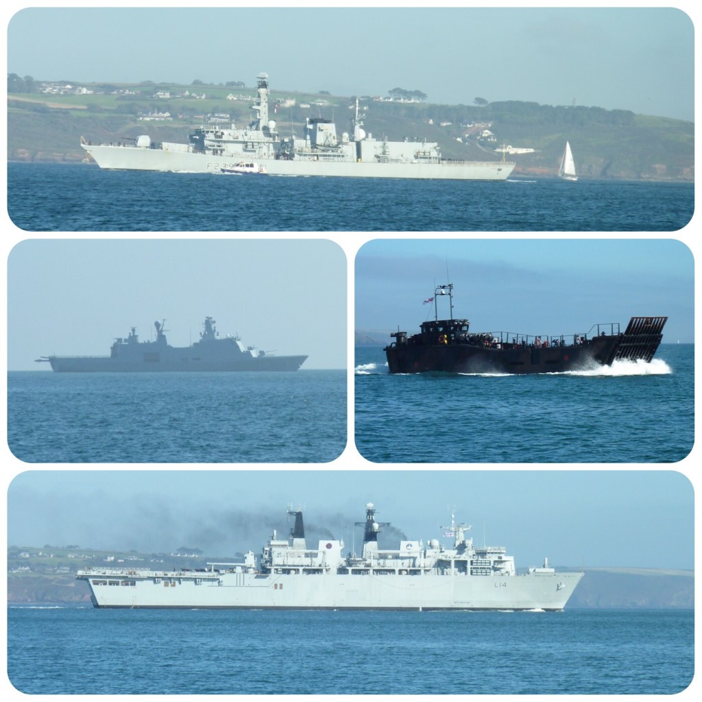
Middle – HDMS Esbern Snare_(L17)


Wednesday 9 September :: Bar closes at 15:00 :: Atmospheric pressure 1035
09:45 We raised the main sail before pulling up the anchor. Then in a light W wind the anchor was up and we “put out to sea” to the Bar before “sunset and evening star”
The sand Bar crosses the entrance to Salcombe leaving 1.2 metre of water at Chart Datum CD. We needed 3 metre to lift LA over the Bar on a falling tide; the tide table calculation was 14:40 to be precise. And we couldn’t sail directly to Salcombe because of the following wind.
Passage plan was agreed and we continued to sail SE by E. Flocks of gannets resting on the surface or making high-speed dives from above throughout this leg. They must be starting to migrate soon from their summer breeding grounds to the Mediterranean. More than two-thirds of the world population breeds around the coasts of the British Isles. Winds now W f4.

Navigation data
TWA 140 degree
AWA120 degree
TWS 12.2 kts
AWS 8.8 kts
COG 130 degree
BTW 050 degree
13:10 TWA angle was 140 degree (40 degree off wind of 180 degree) and we needed to be able to turn and head towards the entrance. If we turned too soon we would head in to the cliffs between Bolt Head and Bolt Tail. “Ready to gybe, helms a lee, gybe o” and Salcombe was in our sights.
A leading line was used to stay on track in the deepest water over the Bar. Remember we had calculated 3 metre above CD and we confidently sailed right in. Now we had to wait for the force of the high atmospheric pressure pressing down from above? We crossed the Bar with 2.2 metre to spare. Some pressure from above …
We were welcomed on arrival by the harbour master boat and escorted to our visitor buoy. Attached, we made a short visit to Salcombe via the gash pontoon and then settled on board for the evening.
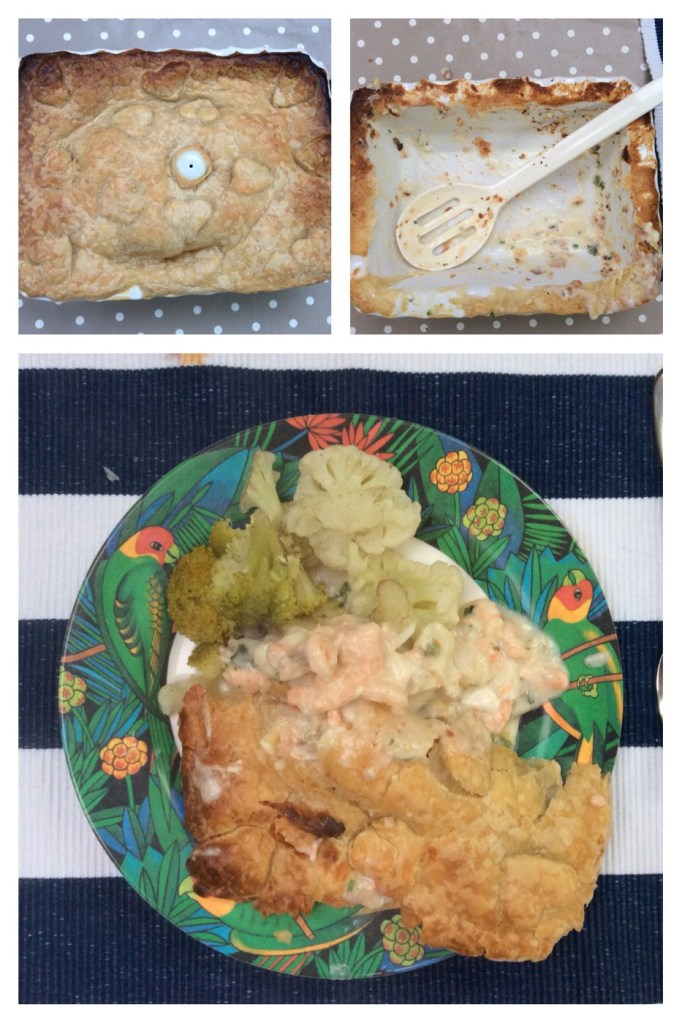
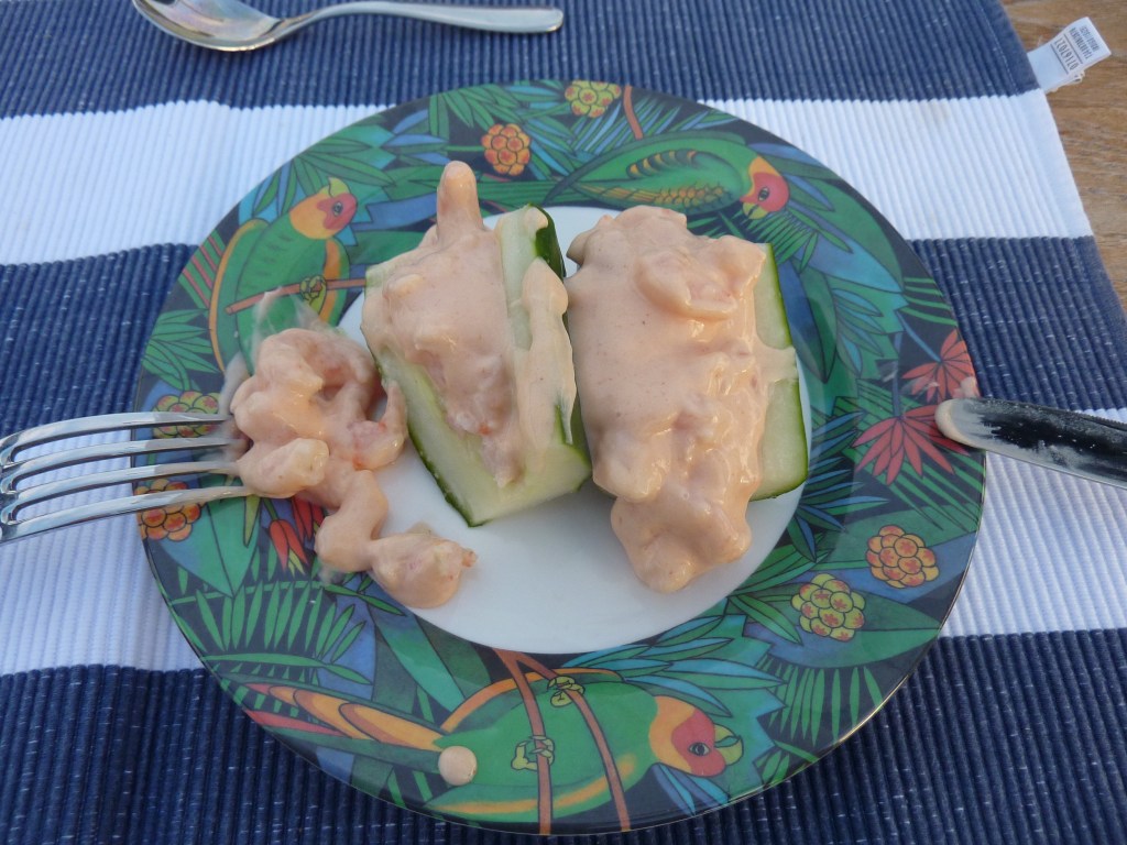
From the start we had planned to eat only onboard and we were now nearing the end. We were accessing fewer ingredients and creating more unusual food combinations – hence cucumber prawn cocktail followed by basa fish on a layer of cabbage on a layer of penne topped with cheese sauce!
Thursday 10 September
Our last day sailing and again we needed to arrive on time due to tides… before the flood tides at Dartmouth 12:00.
Cleared the Bar and sailed along the coast in NE f4 at 7 kts. At Prawle Point we had to stop sailing with winds now head on.
The last few miles were covered and we were back in Dartmouth shortly after midday and safely attached to the pontoon at 12:40.
Editor’s note : 2020 cruise log was written in real time and posted when WiFi was available. Over the next fortnight I’ll add a photo gallery for high spec images of dolphins and links for some video clips following requests via comments box.
