Saturday 26 June
Welcome to Liquid Asset Cruise 2021
Editor’s note
The blog is prepared in real time however WiFi reception is generally problematic when out at sea or in secluded anchorages. Pages may have a lag time before they can be published.
Route planning
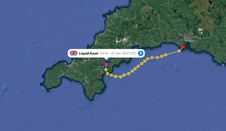
Yacht Liquid Asset is attached firmly to the pontoon in Darthaven Marina and the crew debate their first move. Covid19 rules and restrictions remain and the Channel Islands are not fully open until Thursday. Our only choice is to head West and the Isles of Scilly could be reached if the winds are favourable. So let’s visit the weather charts for next week. Mmmmm… ?
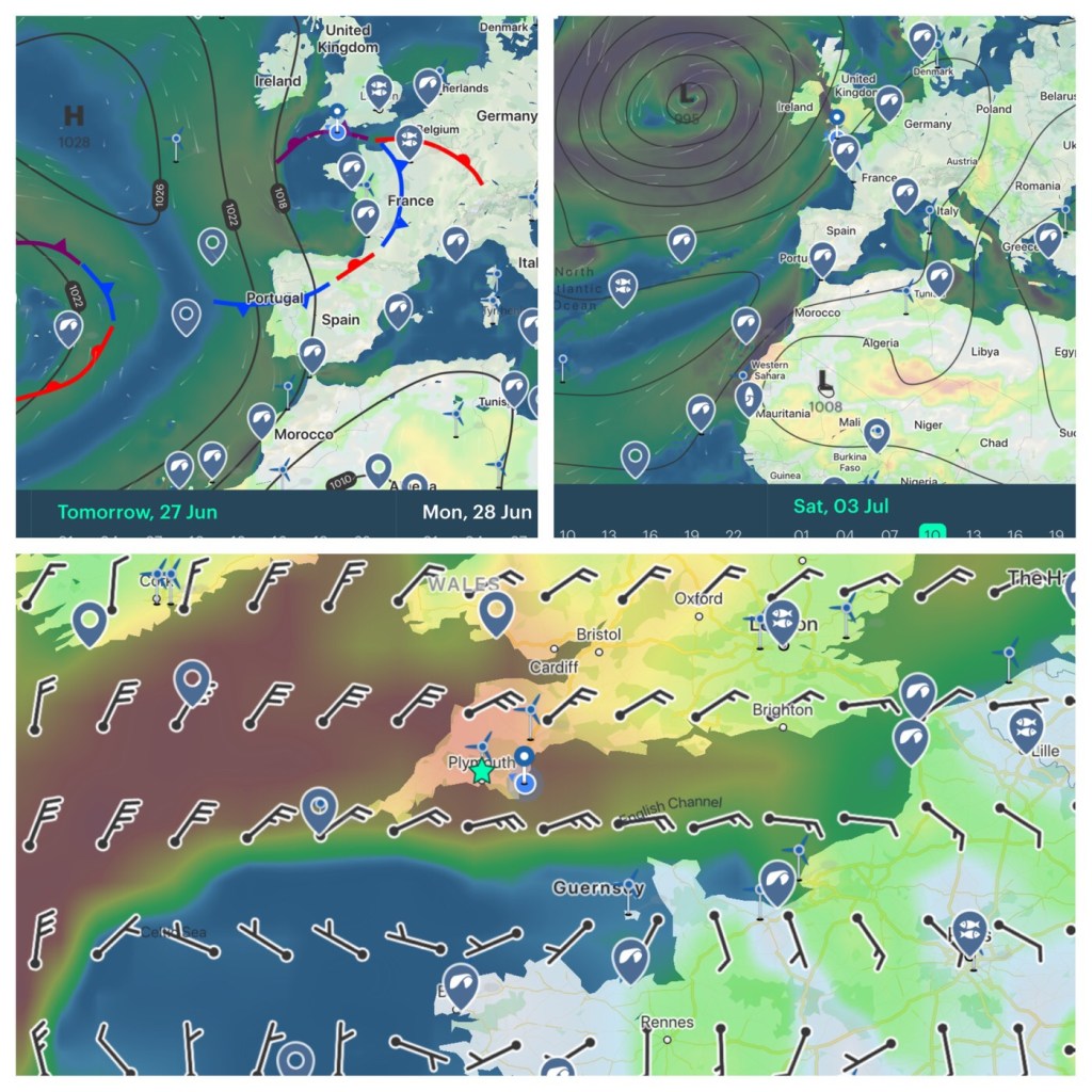
A high pressure system over the Atlantic will be replaced with a low pressure system by next weekend. However (and there is ALWAYS a ‘however ‘) a small but significant low is currently centred over the tip of Brittany. An occluded front will bring strong winds and rain on Sunday. Decision time…
Any suggestions? Do we sit out the blow or head West. Remember we also have a full moon and spring tides to take into account. So here is the first clue for a possible destination.

Choices
Dartmouth offers the visitor many attractions and under ‘normal times‘ we could visit NT Coleton Fishacres, walk long the cliff tops, ferry up river or have lunch at Rockfish restaurant followed by a flavoured ice cream. Time well spent to avoid sailing during the poor weather on Sunday and Monday.
However
We could get further west by setting off early and with light winds and favourable tides reach a safe anchorage by nightfall (Salcombe, Bolt Tail, River Yealm or even Cawsands Bay?)
Time and tide wait for none…

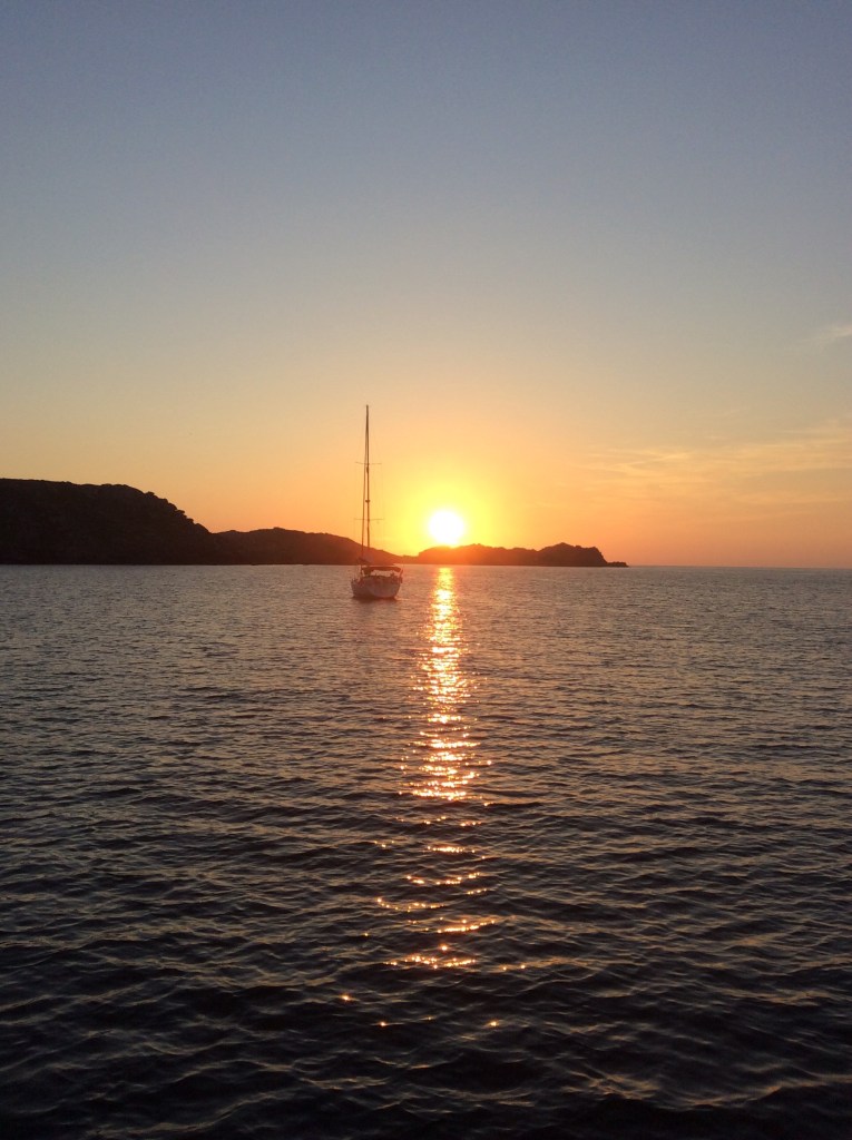
Lines were prepared to depart and then Liquid Asset slowly weaved its way through the plethora of small craft to reach the open seas. A pod of dolphins passed us by at the entrance and again further out at sea.
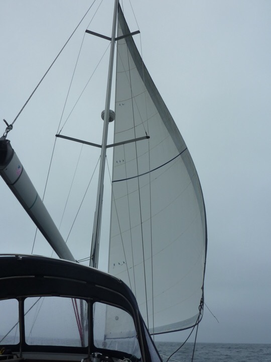
Although the steady NE winds were only 6 – 7 knots, a full set of sails and smooth seas kept the boat speed (speed over the water) at 4 kts. However with the following spring tide of 1.5 kts and we averaged 5.5 SOG (speed over ground) We had time and we had tides…
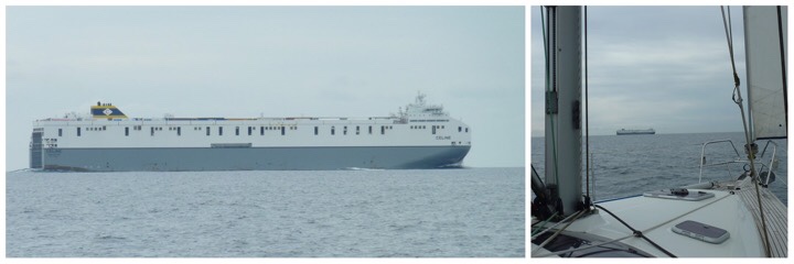
14:30 However Celine was closing in on our track and within a mile distance of each other we both decided to change course – Celine headed towards Dublin and we performed a gybe and headed towards Plymouth.
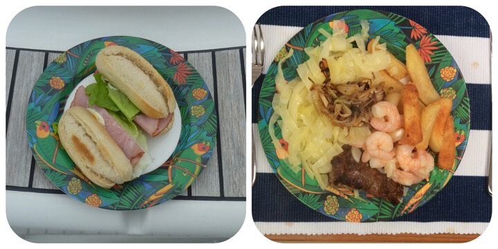
Cawsands Bay :: Surf & turf :: Gently rocking
18:30 Dropped anchor. Not another vessel in sight and we began to doubt our choice of anchorage. However we did have a Plan B just in case. Liquid Asset rocked gently as the rain and strengthening winds closed in. Anchor light on and we settled down for the night

Sunday 27 June
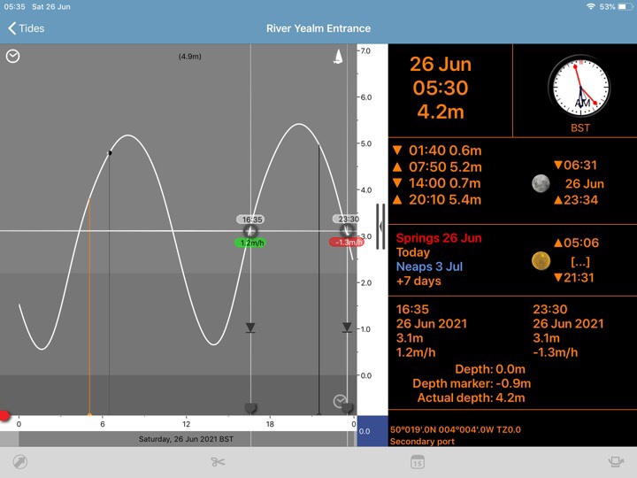
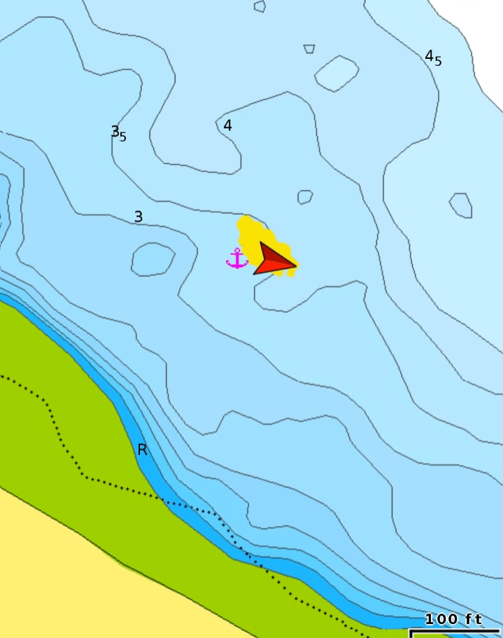
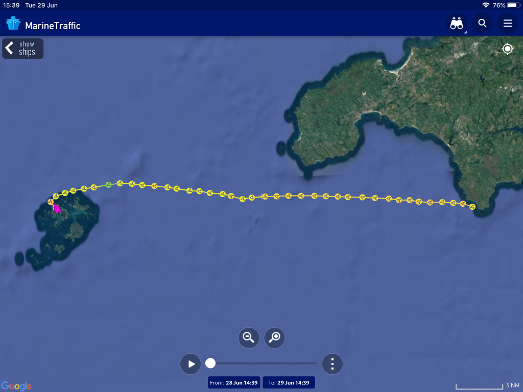
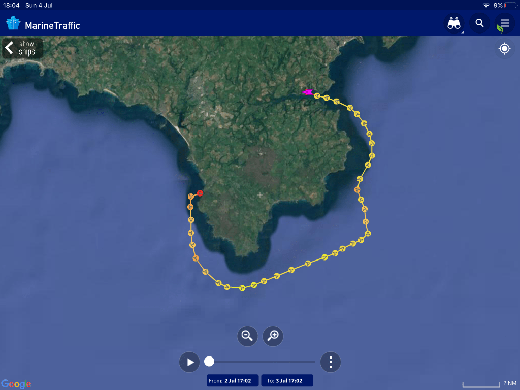
Anchor alarms were set to check our position did not move out of a predetermined ‘safety circle’. Each moment is measured with a yellow dot and plotted on the chart. We stayed in one place on the 3.5 metre contour.
Editor’s note
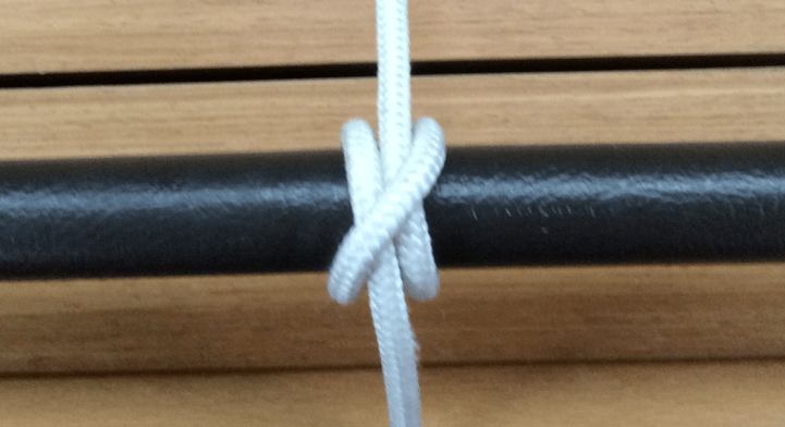
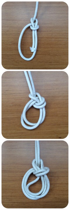
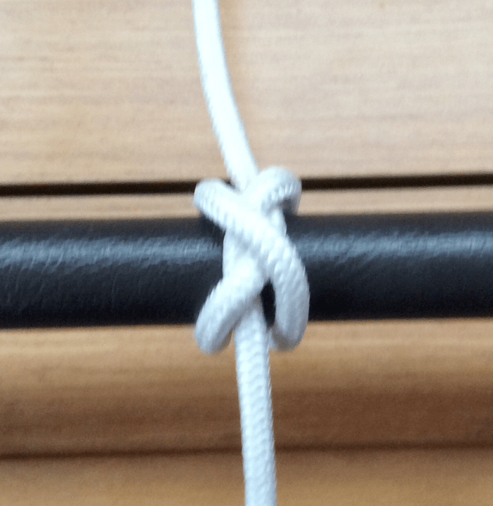
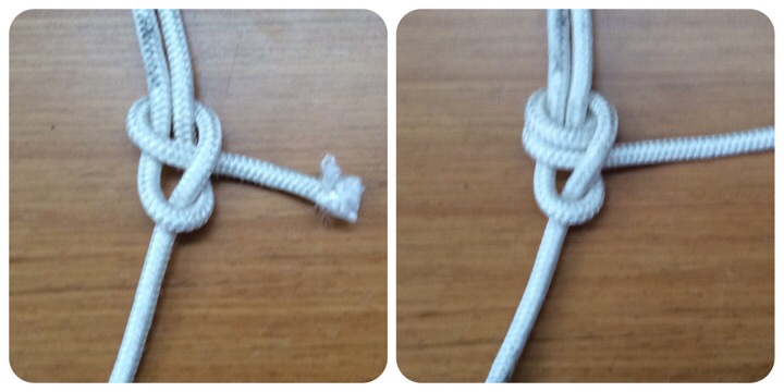
Last year’s quiz was popular and so let’s carry on with a new quiz for this year. Knots are essential on a boat and they help to keep things attached. Test your knowledge.
Wind and rain :: Phenomenal
Of course we have could sat at anchor today and waited for the heavy weather to pass by. However, although the winds are strong (gusting 32 kts), they will take us further west. Heavy weather gear and all hatches battened down, we set sail knowing what was round the corner of Rame Head.
Winds create waves and strong winds create big waves. However the fetch was small unlike winds from the SW over the Atlantic Ocean. They create huge swells and surfing breakers. From our forecast, waves will be 0.2m high and wavelength 6 seconds. A following strong wind and choppy seas meant we sailed with only the one head sail. That was enough to move us in the right direction at 6 kts; heading towards Falmouth.
Rain, rain rain go to Spain…
isAt 14:00 we were halfway and then the rain became heavy. It arrived and visibility diminished with a grey mist that merged with a dark sky. Then the wind suddenly dropped and the surface became smooth and glassy. The heavens opened and huge drops of water splashed down onto the calm seas. It was lonely and an eerie phenomenon. We were in the centre of a cloud.
Within twenty minutes the wind increased again to 17kts and the waves came back. They came from behind and lifted the boat up with ease to the crest and down into the trough every 5 second as forecast. Up and down, up and down, up and down for 3 hours! The rain slowly eased but we were still shrouded in mist. Time seemed to slow down. Then it was time to gybe and we increased our VMG (Velocity Made Good) to the Falmouth waypoint.
River Fal pontoon :: Empty or full?
This pontoon is a favourite spot – a quiet secluded ‘secret’ location. However on arrival, and after a long and weary day, the secret must be out. The pontoon was full.
Having prepared for this possibility, we gently glided up river and set anchor. The wind had gone and the sun broke through. The memory of the grey skies, rough seas and rain dissipated and was replaced with blue sky, glassy smooth waters and an air of calmness.
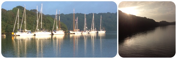
Tranquil evening :: The Joy of Sailing
Our day started off knowing it was going to be unpleasant however the reward of moving west and reaching a perfect spot proved worthwhile.
Monday 28 June
Racing to the Lizard
Our eye was still on the challenge of reaching the IoS and we need to find a jumping off point from mainland UK. Winds today were forecast to ease soon after noon. So we raised anchor and drifted gently past the yachts sitting on the pontoon. The Harbour Master had already been to collect a ££ fee for being attached to a long piece of wood. By anchoring, we escaped that pain.
We motored down river and viewed the grand properties along the shoreline. Soon we were passing Black Rock at the entrance of Falmouth Harbour and then out to sea. Sails set and steady easterly winds and we set off southwards to Lizard Point. It wasn’t long before we were catching up with Wild Goose ( Oyster 49’ blue hull). It seems we were heading on the same course – two yachts and one race gets underway …
Manacles east cardinal :: Halfway
Sailing relies on winds and also wind direction. A yacht cannot sail directly into wind and different wind angles create different conditions to sail in. Then there are the navigational obstructions to consider for example rocks and shallows. So when two yachts are ‘racing’ they follow best course to wind and avoid nature’s hazards. The cardinal mark was our first challenge and the warning bell atop sounded as we passed it by. Wild Goose was to follow.
The Cornish village Coverack was abeam when the winds fell, sails were lowered and we began to motor towards the next turning point. Wild Goose had started their engine sooner and They were now ahead. We innocently set our speed to 6.5kts vs their 6.0kts. Lizard Point reached in ideal conditions and we passed the most southern point of UK. Wild Goose was to follow.
Kaynance Cove anchorage
The west coastline north of Lizard has few safe anchorages due to the serpentine rocks. We planned to anchor in a small bay with limited space (room for one?) As we approached slowly and carefully we noticed Wild Goose heading in behind us. And they were increasing their speed from 6.0kts to 6.5kts to 6.8kts. Their intentions were clear, however ‘rules of the road’ would have to be obeyed. Liquid Asset anchored in 3.5m LW off Asparagus Island. Wild Goose was to follow.
It was a ‘Wild Goose’ chase…
Sun dog :: swimming
“Look there’s a sun dog” “where? Oh yes, you rarely see that in the summer months“ Sundog link
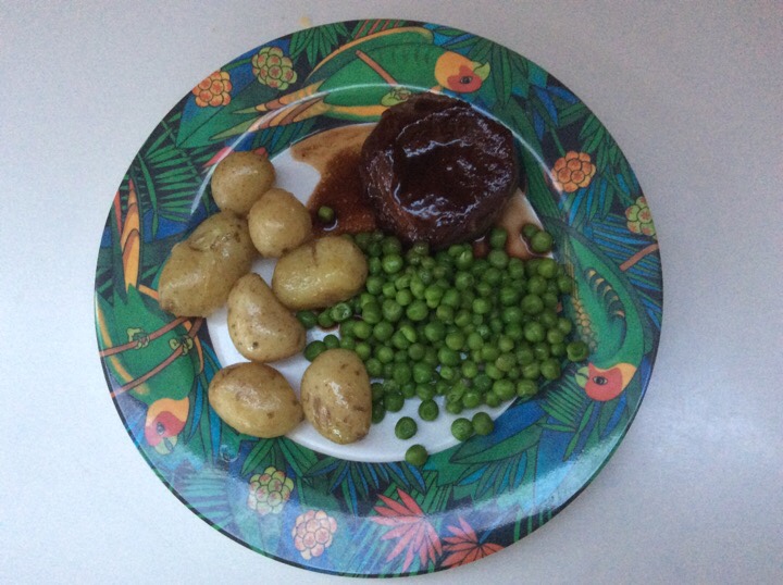
Safely away from the beach throngs, wet suits were donned and we had our own swimming party – sorry no photographs. And of course there was only one choice of ingredient for tonight’s dinner…
Kaynance Cove was full of holidaymakers and the seaside cafe was open for business. Kaynance Cove link
Anchorage in sheltered bay with no communication channels and surrounded by impressive walls of serpentine – Asparagus Island, Gull Rock and Lion Rock.
Tuesday 29 June
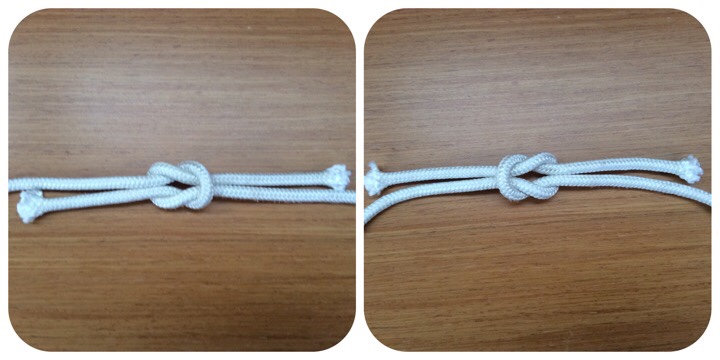
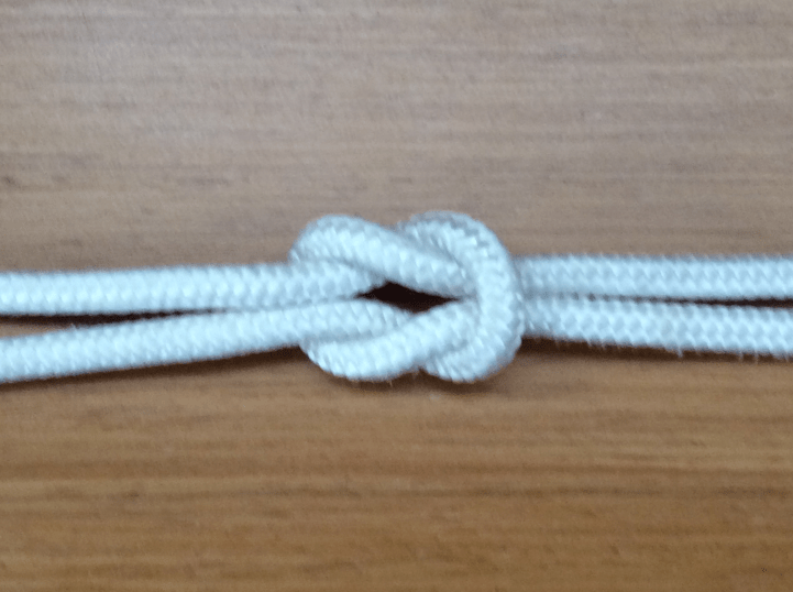
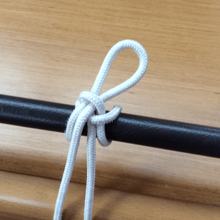
Knot quiz #3 could be one of two knots. Can you spot the difference and name them?
07:00 Departed from anchorage and sailed westwards with a northerly force 4 and tide against. Waypoint set for IoS and distance to waypoint DTW 42NM. Estimated passage time 7hr at 6kts or 6hr at 7kts.
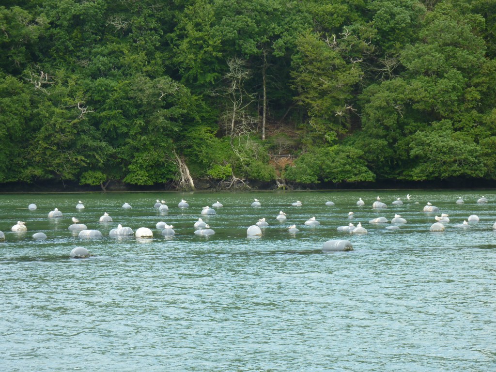
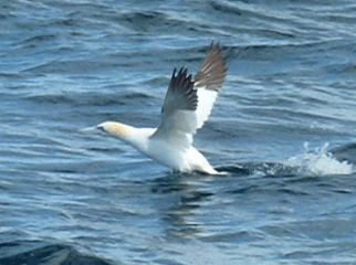
Steady 10kts winds and full sails were raised to drive Liquid Asset forward. Gannets were disturbed from their sleep, heads resting on their body. Young birds still had dark plumage and had already learnt to dive into the water to catch fish. Adults, with golden heads and black wing tips, flew together in groups, youths taking up the rear.
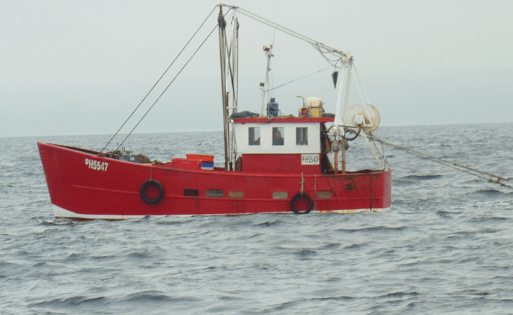
We passed a small trawler with trailing lines taught as she pull at the nets.
Then a sparkle of light just under the surface suggested a sun fish swimming. Alas it was just an empty packet of cheese and onion crisps!
Setting sails for strong winds
It’s a known fact that every sailing vessel has a maximum boat speed through the water. As the wind strengthens and the yacht moves forward a bow wave is created that causes resistance. The sails were filing with wind and this pushed the boat over sideways and the we began to heel.
09:30 Winds increased to 15kts and SOG 7.2kts. We reduced both sails to 3 reefs but still managed to keep the boat speed high in 13kts winds- a steady 7-8kts and our maximum boat speed was 9.3kts. Flying along straight to our destination.
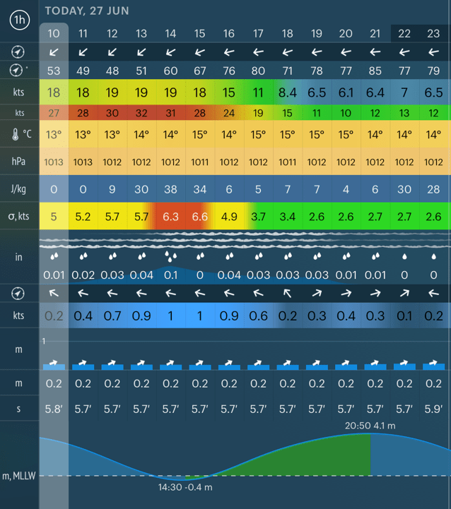
Navigation data
Navigational equipment captures data from devices spread throughout the vessel (anemometer, GPS, speed and wind vanes.) This provides the navigator and helmsman with all the information to keep on track, set the sails and stay data in safe waters. At the midway point on this passage we have the following data (key metrics) :-
It may not be a surprise that within 30 minutes, each of these boxes of data will have changed.
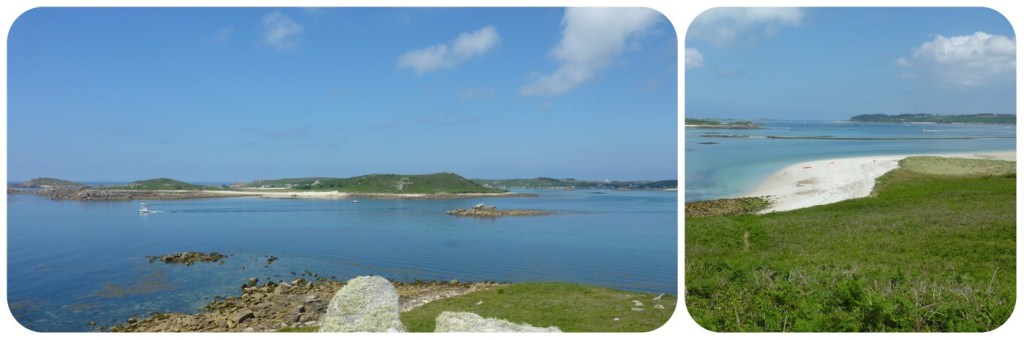
Isles of Scilly
We arrived and picked a visitor buoy in New Grimsby Sound. The last 3 days passage planning are now complete. A perfect spot “I must be dreaming”
Wednesday 30 June
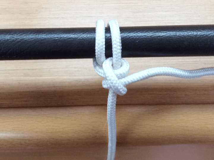
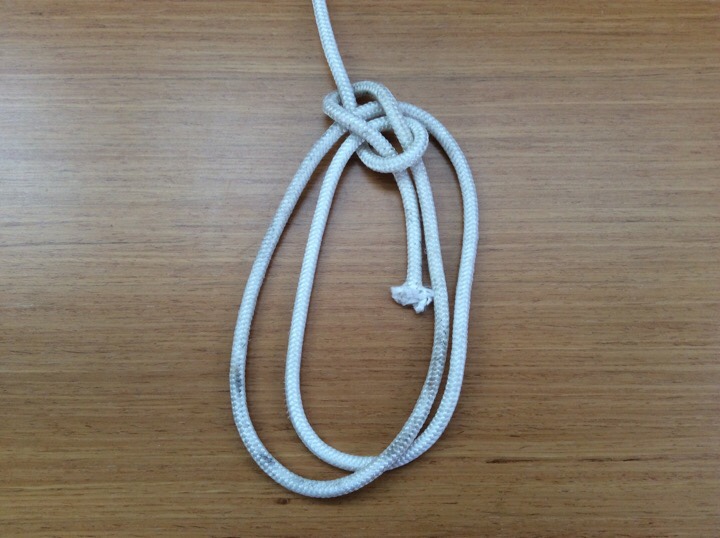
Knot quiz #4 – Can you name all three ?
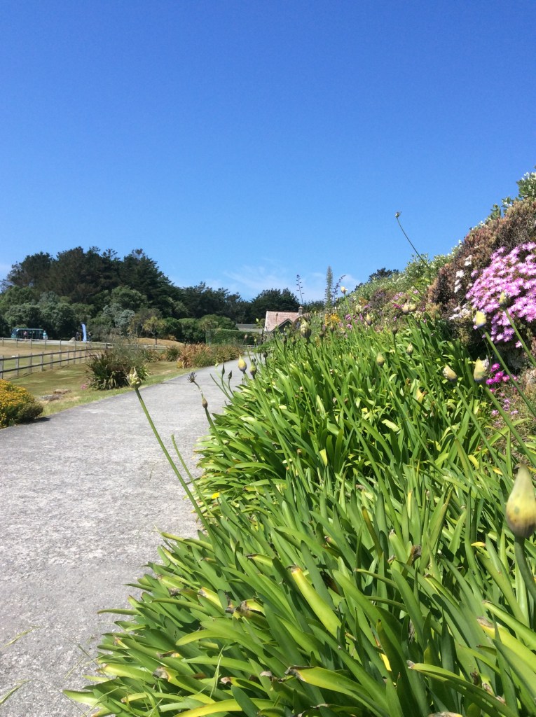
Shore party to Tresco :: Tresco Abbey Gardens


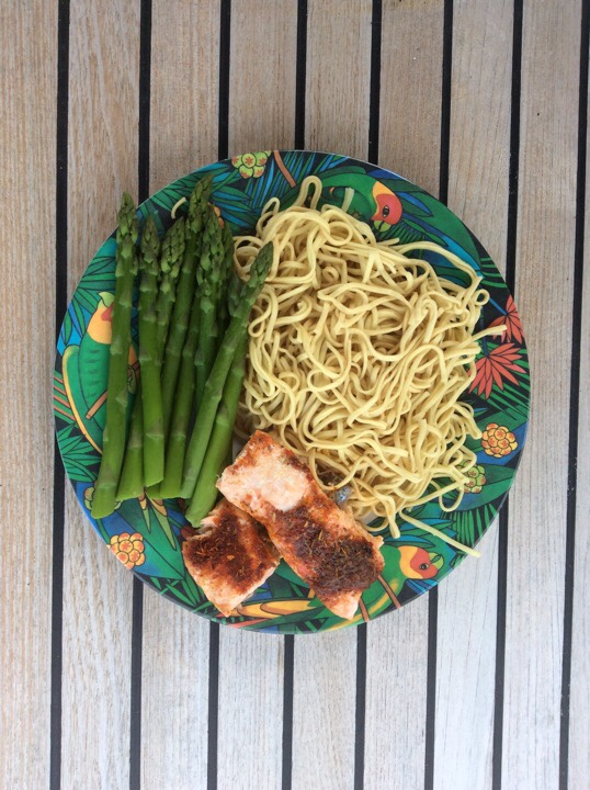
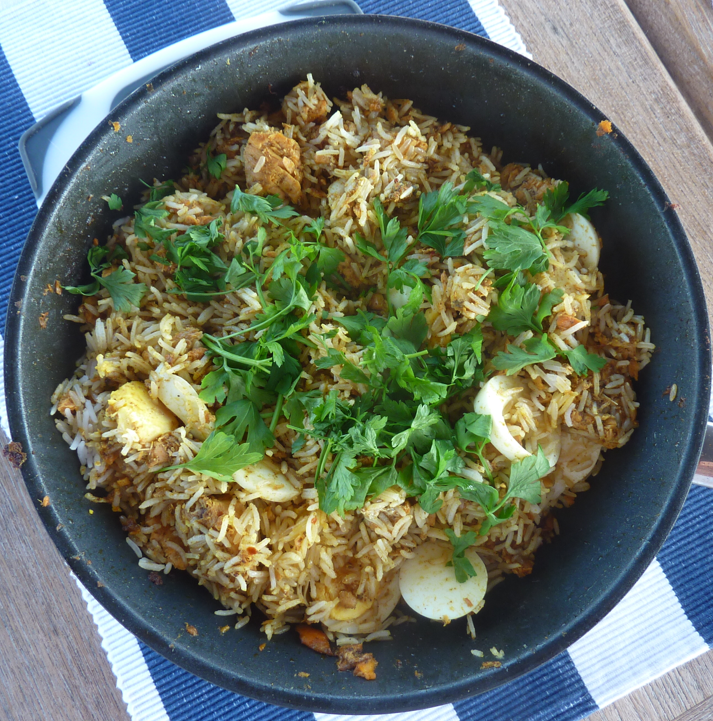
And after all that exercise, a fine kedgeree to enjoy before the sun went down…
Thursday 1 July
Shore party to an uninhabited island
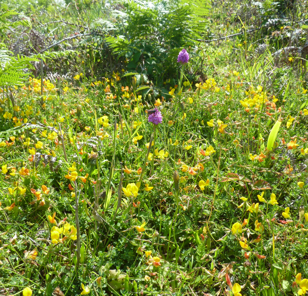
Apart from the main islands there are many uninhabited ones with inviting stretches of white sands. We set off in the dingy through the shallow waters of Tresco Flats to arrive on the shore of Samson Island. A quick swim in the clear turquoise sea followed by a picnic on the beach. Views from the hilltop were stunning. Rock pipits and stonechats made their presence known and the air was filled with the sweet smell of honeysuckle. Heather, ferns, bramble and foxgloves covered the hillside. Wild orchids grew among the ladies mantle.
Seaweed forest in shallow waters
As the tide was falling, more rocks and shallows were exposed. Long strands of seaweed now darkened the surface. We weaved through these forests to avoid the weed wrapping round our propeller.
Safely out of the shallows, we landed on Bryher Island for a speciality flavoured ice cream – geranium for one and salted caramel for another.

Friday 2 July
Can you remember the weather system forcasts from last Saturday? The Atlantic high pressure would be replaced with a low pressure system. Sunny days of calm to be replaced with stronger winds and rain. Should we sail today or wait for the strong winds and high waves arriving Saturday?
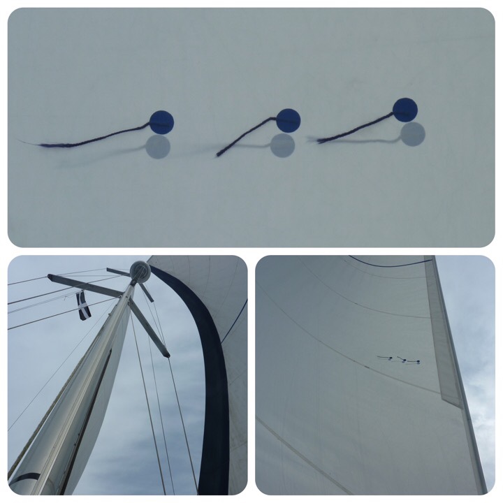
We left the anchorage and headed out into the Celtic Sea. Winds were light, sea was calm and a full set of sails were set. Tell tail threads were flowing horizontally indicating the wind flowed smoothly over the head sail.
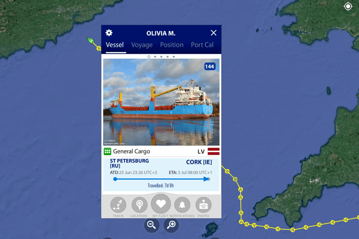
Shipping channel north
Crossing a shipping channel requires some care. Cargo vessels, tankers and container ships travel along them using the separation zones to keep apart from each other. Aethalia passed behind safely 0.66NM however a 300 foot tanker Olivia M from St Petersburg was dead ahead. ‘Rules of the Road’ gives a sailing vessel the right of passage. And in plenty time, she turned away as we sailed safely by on our predetermined course.
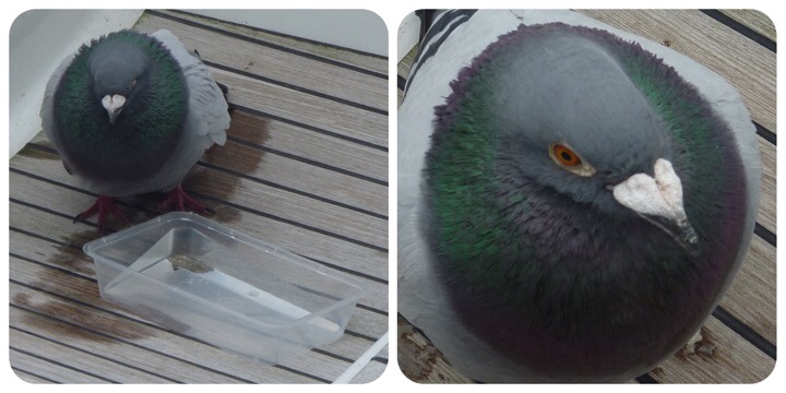
‘Percy’ pigeon hitched a lift
Out of nowhere, a racing pigeon landed on the back of Liquid Asset and then hopped onto the deck next to the helmsman. Exhausted and grateful of a landing spot, it decided to find a place to rest and remained our companion until we reached land. Water and refreshments were provided and thankfully received. Parting gifts were washed away with a bucket of seawater

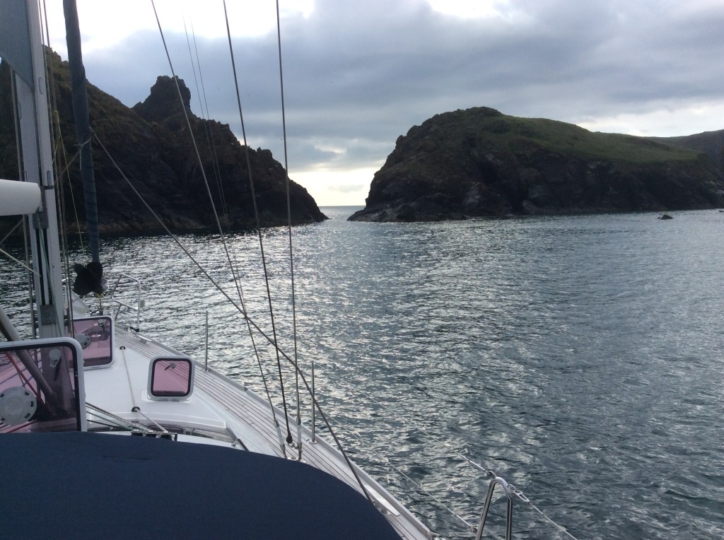
Mullion Cove anchorage
After tacking once to give enough sea room to clear the rocks off Lizard, we later decided to anchor behind Mullion Island at Mullion Cove.

Saturday 3 July
Editor’s note
Today we will head around Lizard Point towards the River Helford. This anchorage has had no WiFi reception in past years.
Stay clear of ‘The Lizard’
10:00 We raised the anchor and set off out into open waters. The strong winds had built up the waves and we motored high and low like a roller coaster.
Lizard Point juts out into the English Channel between two wide bays. Tides sweep along each bay in turn and gathers at ‘The Lizard‘. When wind over tide coincides, the standing waves and undercurrents are too turbulent for a safe passage. We had timed our departure for wind with tide and stood off the coast by one mile giving a high margin of safety.
We sailed past Lizard Point and then around the Manacle cardinal into the River Helford. We anchored in 5 metre (2 metre fall in tide over 12 hours) opposite the NT Trebah beach.
YouTube link of Manacle East Cardinal
Anchoring
The art of anchoring is bewildering – what is the depth, how much chain, how close are we to the shoreline, how near are the other boats, what is underneath, what is the tidal range, what are we anchoring in to? Is it secure?
Firstly we can find suitable anchorages from the charts and the surface is marked as sand, mud or gravel etc. Secondly, we know the tidal range from published tables and we know our depth from the yacht’s gauge. As a general rule we will lay out three times the maximum depth for the length of chain (scope). Lastly, check that the shore and neighbouring vessels are not too close. Remember at low water, the vessel is further away from the anchor point and the shoreline comes closer.


Finally raise an anchor ball above the foredeck and an switch on the anchor light at night.
Sunday 4 July
Editor’s note
Today in River Helford. This anchorage has no WiFi reception. Short shore party for provisions and WiFi
