Shipping forecast
Plymouth
Wind
Northwest 4 to 6.Sea state
Moderate or rough.Met Office
The final leg was taken from the master plan to use another strong westerly and continue the journey eastwards towards home. We will venture out into a Force 5 because we know the AWS is greatly reduced.
However not so fast; there is a not so subtle change in the forecast ! Can you spot it and the altered sail plan below from yesterday?

Yes, the wind has veered from southwest to northwest. It remains downwind however there is a northerly component and we will have to sail on a port tack. And it turns out that there was more force 6 in reality. Yes, fundamentally the same, except the COLREGs Rule 12 dictate we be the give way vessel in more encounters with other sailing vessels.
Summary of the Altered Sail Plan (Today vs. Yesterday):
* Wind Direction: Southwest (Westerly) to Northwest (Northerly component).
* Wind Force: Anticipated Force 5 to Actual Force 6.
* Sailing Angle/Tack: Likely directly downwind or starboard broad reach to Port Tack Broad Reach/Deep Broad Reach.
* Sail Configuration: More aggressive reefing/smaller headsail required due to Force 6.
* Navigational Responsibility: Increased give-way obligations under COLREGs due to being on port tack.
The “subtle change” was anything but subtle in its implications for actual sailing and safety!AI comment
Even with the significantly stronger wind and its northerly direction, the journey was good all the way to Brixham. Good visibility and a much better sea state and tide with us, we gobbled up the miles. And no close encounters with other yachts as very few ventured out into a Force 6! We turned the corner at Start Point and continued on a broad reach with reefs in the sails. The winds strengthen all the time.

Brixham harbour anchorage
Northerly winds continued to increase (27 kts) and the anchorage offered no protection even though it was surrounded by high ground. There was no safe space to anchor here. No sea space to manoeuvre.
And although the wind will abate gradually at first, it was forecast to blow through at 30 kts (gale force 7) in the wee small hours. We had to leave and find a safe haven. Dartmouth.

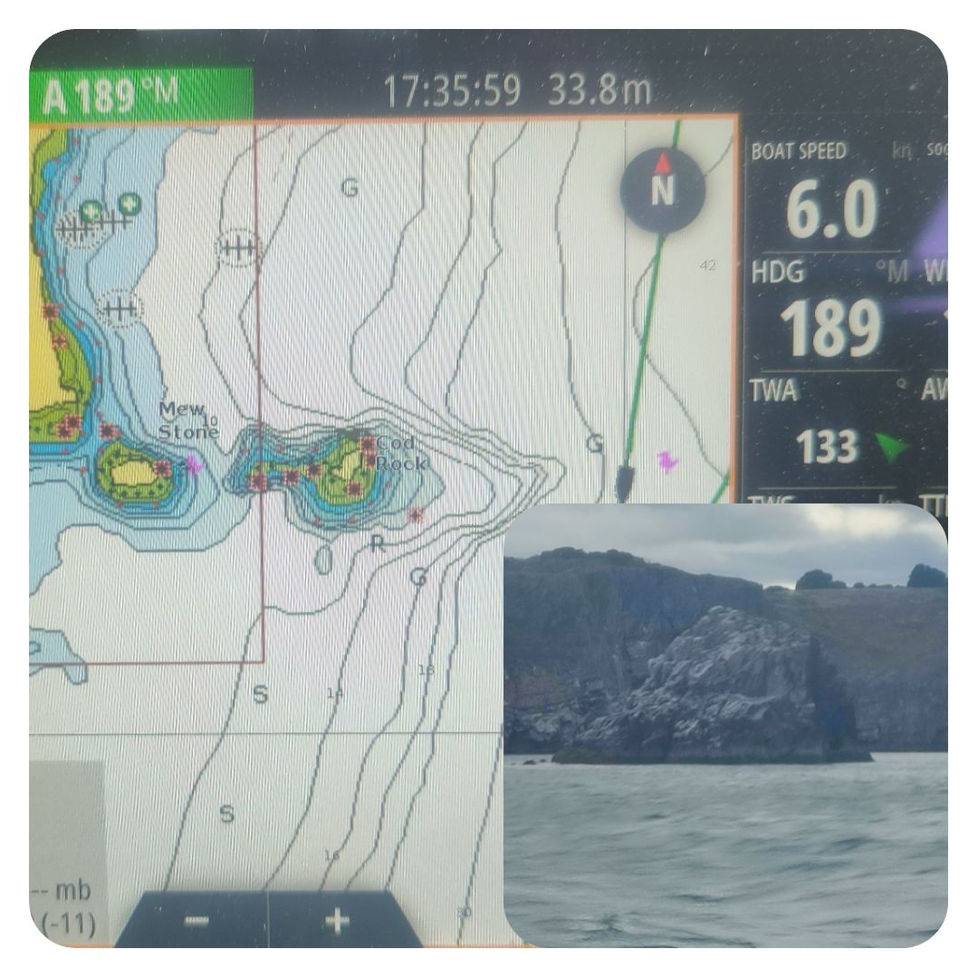
Cod Rock
We motored back a few miles towards Dartmouth and followed the coast. Visibility was good and we avoided the many named rocks jutting out of the water: Cod Rock, East Blackstone Rock, West Blackstone Rock, and the Mew Stone. Well placed cardinals kept us safely away from the danger.
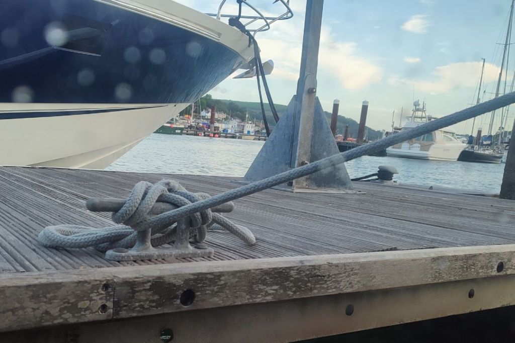
Safe Haven
We navigated the narrow entrance between the castles using the chart, leading lines and navigation lights. A pause on arrival to wait until the flood tide ends at 21:30. We just anchored in the harbour for a couple of hours. Then onto a pontoon for the night. Note: this is the first time we tied onto anything for the whole cruise!
The winds howled all night through, halyards frapping loudly against the masts, and the lines creak against the pull of the yacht. Going nowhere!


Zzzz
